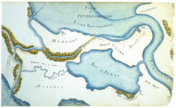
Plan of the Land around Fort Petites Coquilles
A color reproduction of a map depicting a plan of the Land around Fort Petites Coquilles

Courtesy of The Historic New Orleans Collection
Plan of the Land around Fort Petites Coquilles. Barthelemy Lafon
Additional Data
| Courtesy of | The Historic New Orleans Collection |
| Collection | Acquistion made possible by the Clarisse Claiborne Grima Fund. |
| Date | 1814 |
| Copyright | Copyrighted |
| Disclaimer |
Physical rights are retained by the Historic New Orleans Collection. The Louisiana Endowment has included this work in 64parishes.org for the purposes of criticism, comment, teaching, scholarship, educational research, all other nonprofit educational usages under Section 107 of the U.S. Copyright Act. |