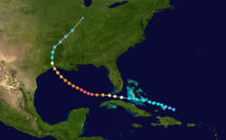
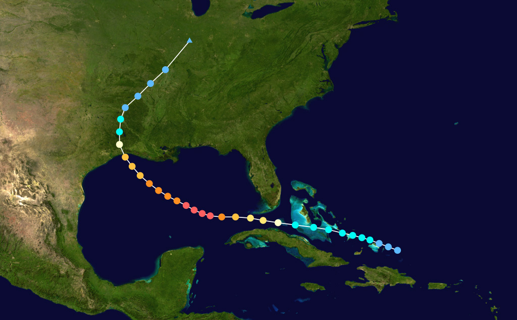
Hurricane Rita Storm Path
In 2005 Hurricane Rita made landfall through southwestern Louisiana. This illustration, with the Saffir-Simpson Hurricane Scale color scheme, shows the location of the storm from September 18–25 in 2005. The tracking data is from the National Hurricane Center's Atlantic hurricane database.
Courtesy of Wikimedia Commons
Hurricane Rita Storm Path. National Hurricane Center
Additional Data
| Courtesy of | Wikimedia Commons |
| Date | 2005 |
| Copyright | Public Domain |
| Disclaimer | This work has been released into the public domain by its author, Iune. This applies worldwide. The Louisiana Endowment has included this work in 64parishes.org for the purposes of criticism, comment, teaching, scholarship, educational research, all other nonprofit educational usages under Section 107 of the U.S. Copyright Act. |