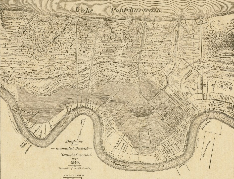
Diagram Showing the Inundated District, Sauvé’s Crevasse
Map of New Orleans showing the Mississippi River crevasse at lower left and portions of the city inundated by the 1849 flood in darker shading.

Courtesy of The Historic New Orleans Collection
Diagram Showing the Inundated District, Sauvé’s Crevasse. Ludwig von Reizenstein, delineator
Additional Data
| Courtesy of | The Historic New Orleans Collection |
| Collection | The L. Kemper and Leila Moore Williams Founders Collection |
| Date | 1886 |
| Copyright | Fair Use |
| Disclaimer | The Louisiana Endowment for the Humanities has included this work on 64parishes.org for the purposes of criticism, comment, teaching, scholarship, educational research, and all other nonprofit educational usages under Section 107 of the U.S. Copyright Act. |
