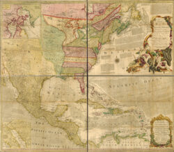
1763 Map of North America
In this 1763 map of North America, cartographer Emanuel D. Bowen distinguishes the British, Spanish, and French dominions.
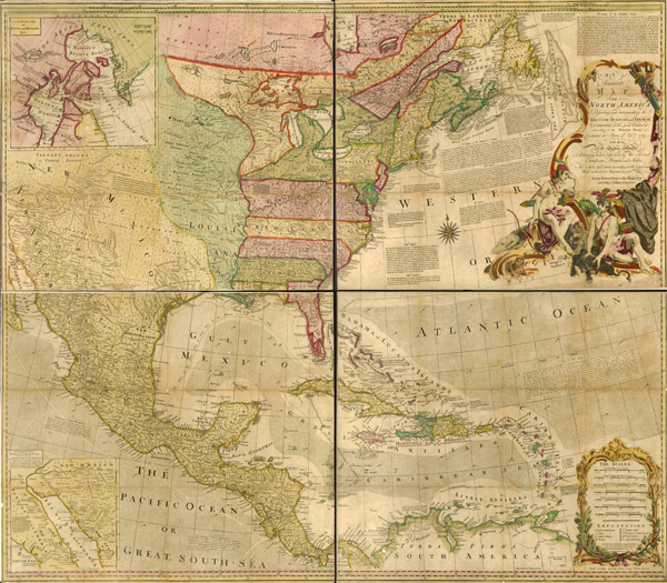
Courtesy of Library of Congress, Geography and Map Division
1763 Map of North America. Bowen, Emanuel D. (Cartographer)
Additional Data
| Courtesy of | Library of Congress, Geography and Map Division |
| Date | 1763 |
| Copyright | Public Domain |
| Disclaimer |
The maps in the Map Collections materials were either published prior to 1922, produced by the United States government, or both (see catalogue records that accompany each map for information regarding date of publication and source). The Library of Congress is providing access to these materials for educational and research purposes and is not aware of any U.S. copyright protection (see Title 17 of the United States Code) or any other restrictions in the Map Collection materials. Note that the written permission of the copyright owners and/or other rights holders (such as publicity and/or privacy rights) is required for distribution, reproduction, or other use of protected items beyond that allowed by fair use or other statutory exemptions. Responsibility for making an independent legal assessment of an item and securing any necessary permissions ultimately rests with persons desiring to use the item. |