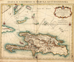
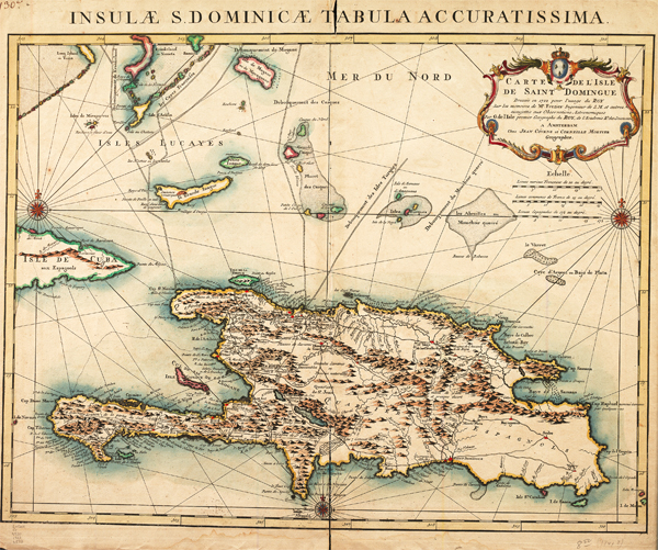
Carte de l'isle de Saint Domingue
Guillaume de Lisle created this map of Santo Domingo in 1722, which indicates the island's French and Spanish “Quartiers,” as well as the surrounding islands, shoals, and reefs. The map was titled "Carte de l'isle de Saint Domingue dressee en 1722 pour l'usage du Roy sur les memoires de Mr. Frezier, ingenieur de S. M. et autres, assujetis aux observations astronomiques par G. de l'Isle."
Courtesy of Louisiana State University Libraries, Special Collections
Carte de l'isle de Saint Domingue. L'Isle, Guillaume de (Cartographer)
Additional Data
| Courtesy of | Louisiana State University Libraries, Special Collections |
| Date | 1722 |
| Copyright | Copyrighted |
| Disclaimer |
The Louisiana Endowment has included this work in 64parishes.org for the purposes of criticism, comment, teaching, scholarship, educational research, all other nonprofit educational usages under Section 107 of the U.S. Copyright Act. Physical rights are retained by the LSU Libraries. Copyright of the original material is retained in accordance with U.S. copyright laws. Permission to reproduce this image must be requested through the Special Collections Division, Louisiana State University Libraries. |