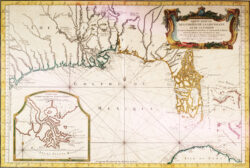
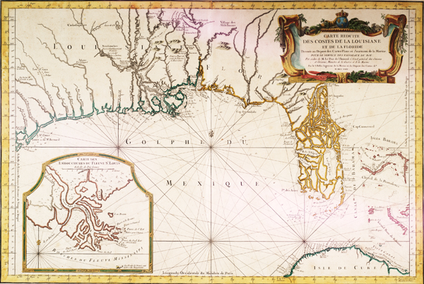
Carte reduite des costes de la Louisiane et de la Floride
Color reproduction of a 1764 French map depicting the Gulf Coast region of North America.
Courtesy of Louisiana State University Libraries, Special Collections
Carte reduite des costes de la Louisiane et de la Floride. Bellin, Jacques Nicolas (Cartographer)
Additional Data
| Courtesy of | Louisiana State University Libraries, Special Collections |
| Date | 1764 |
| Copyright | Copyrighted |
| Disclaimer | The Louisiana Endowment has included this work in 64parishes.org for the purposes of criticism, comment, teaching, scholarship, educational research, all other nonprofit educational usages under Section 107 of the U.S. Copyright Act. Physical rights are retained by the LSU Libraries. Copyright of the original material is retained in accordance with U.S. copyright laws. Permission to reproduce this image must be requested through the Special Collections Division, Louisiana State University Libraries. |