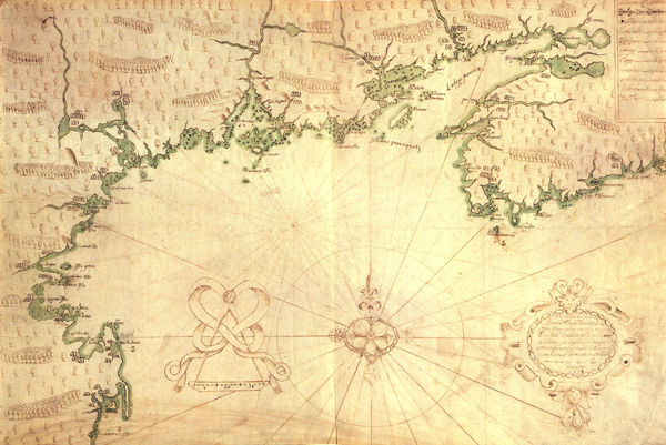
Descripsion des costs, pts., rades, illes de la Nouuele France faict selon son vray méridien: avec la déclinaison de la ment de plussieurs endrois selon que le Sieur de Castes le franc le démontre en son
Color reproduction of pictorial map of the northeast coast of North America by Samuel de Champlain c.1607.

Courtesy of Library of Congress Prints and Photographs Division
Descripsion des costs, pts., rades, illes de la Nouuele France faict selon son vray méridien: avec la déclinaison de la ment de plussieurs endrois selon que le Sieur de Castes le franc le démontre en son. Champlain, Samuel de (Cartographer)
Additional Data
| Courtesy of | Library of Congress Prints and Photographs Division |
| Collection | Library of Congress, Geography and Map Division. |
| Date | 1607 |
| Copyright | Public Domain |
| Disclaimer | The Louisiana Endowment has included this work in 64parishes.org for the purposes of criticism, comment, teaching, scholarship, educational research, all other nonprofit educational usages under Section 107 of the U.S. Copyright Act. The Louisiana Endowment for the Humanities believes this image to be in the public domain and knows of no restrictions on publication. |
