Hurricane Betsy Tracking
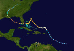
Hurricane Betsy's track in September 1965 is illustrated with mapping data from the National Oceanographic and Atmospheric Administration. The colorized dots show wind speeds specific to the Saffir-Simpson hurricane scale.
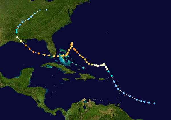
Courtesy of Wikimedia Commons
Hurricane Betsy Tracking. Unknown
Additional Data
| Courtesy of | Wikimedia Commons |
| Collection | National Hurricane Center |
| Date | 1965 |
| Copyright | Public Domain |
| Disclaimer | The Louisiana Endowment for the Humanities has included this work in 64parishes.org for the purposes of criticism, comment, teaching, scholarship, educational research, and all other nonprofit educational usages under Section 107 of the U.S. Copyright Act. |