Laurel Valley Plantation
An aerial view of Laurel Valley Plantation taken in 1906 from the top of a water tower, depicting the sugar fields.
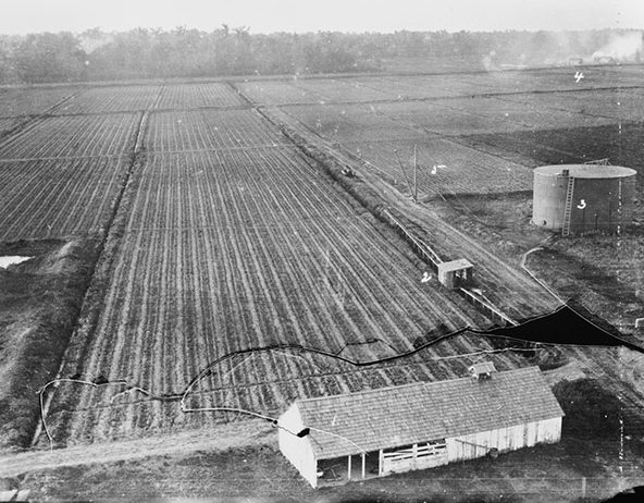
Courtesy of Library of Congress Prints and Photographs Division
Laurel Valley Plantation. HABS
Additional Data
| Courtesy of | Library of Congress Prints and Photographs Division |
| Collection | Historic American Buildings Survey/Historic American Engineering Record/Historic American Landscapes Survey |
| Date | ca. 1906 |
| Copyright | Public Domain |
| Disclaimer |
The Louisiana Endowment has included this work in 64parishes.org for the purposes of criticism, comment, teaching, scholarship, educational research, all other nonprofit educational usages under Section 107 of the U.S. Copyright Act. |
