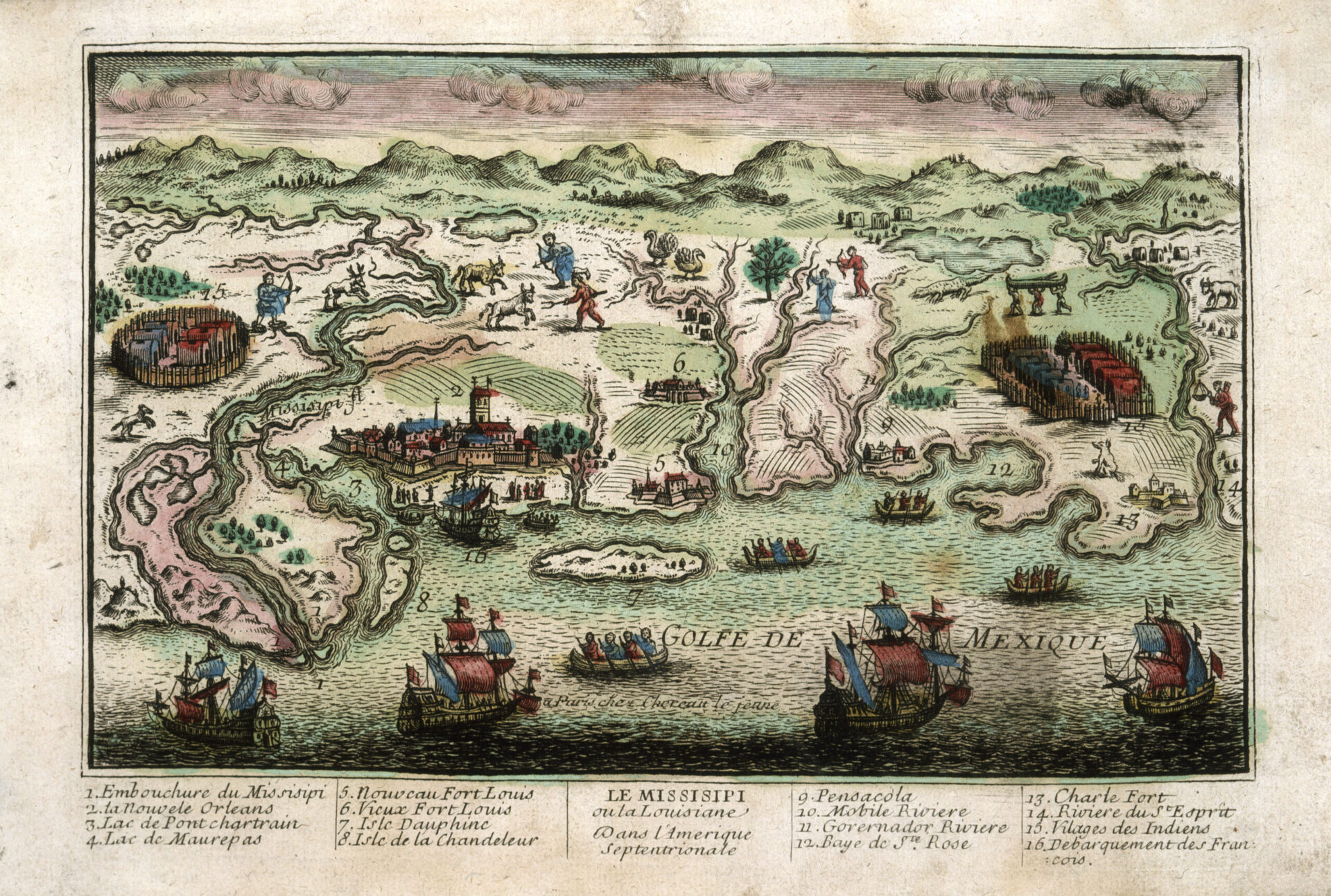
Le Missisipi ou la Louisiane Dans L’Amerique Septentrionale, ca. 1715–1725
Woodcut map providing an (inaccurate) bird's-eye view of Louisiana's gulf coast including "Vilages des Indians" and representations of Indigenous people.

Courtesy of The Historic New Orleans Collection
Le Missisipi ou la Louisiane Dans L’Amerique Septentrionale, ca. 1715–1725. Francois Chéreau, engraver
Additional Data
| Courtesy of | The Historic New Orleans Collection |
| Date | 1715–1725 |
| Copyright | Copyrighted |
| Disclaimer | The Louisiana Endowment for the Humanities has included this work on 64parishes.org for the purposes of criticism, comment, teaching, scholarship, educational research, and all other nonprofit educational usages under Section 107 of the U.S. Copyright Act. All rights reserved by The Historic New Orleans Collection. |
