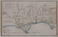
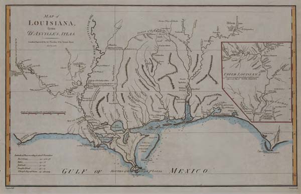
Map of Louisiana Tribes
This early map from d'Anville's Atlas depicts colonial Louisiana, St. Catherine, and the "shaking marshes" of several Indian tribes such as the Choctaw Indians, "Lake Ouachas" just southwest of Lake Pontchartrain, Barataria Bay, Lake Salvador, and Bayou Lafourche, the "River of the Chitimachas."
Courtesy of Louisiana State Museum
Map of Louisiana Tribes. Haywood, James
Additional Data
| Courtesy of | Louisiana State Museum |
| Date | 1788 |
| Copyright | Copyrighted |
| Disclaimer | The Louisiana Endowment has included this work in 64parishes.org for the purposes of criticism, comment, teaching, scholarship, educational research, all other nonprofit educational usages under Section 107 of the U.S. Copyright Act. Physical rights are held by the Louisiana State Museum in accordance with U.S. federal copyright laws. |