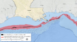
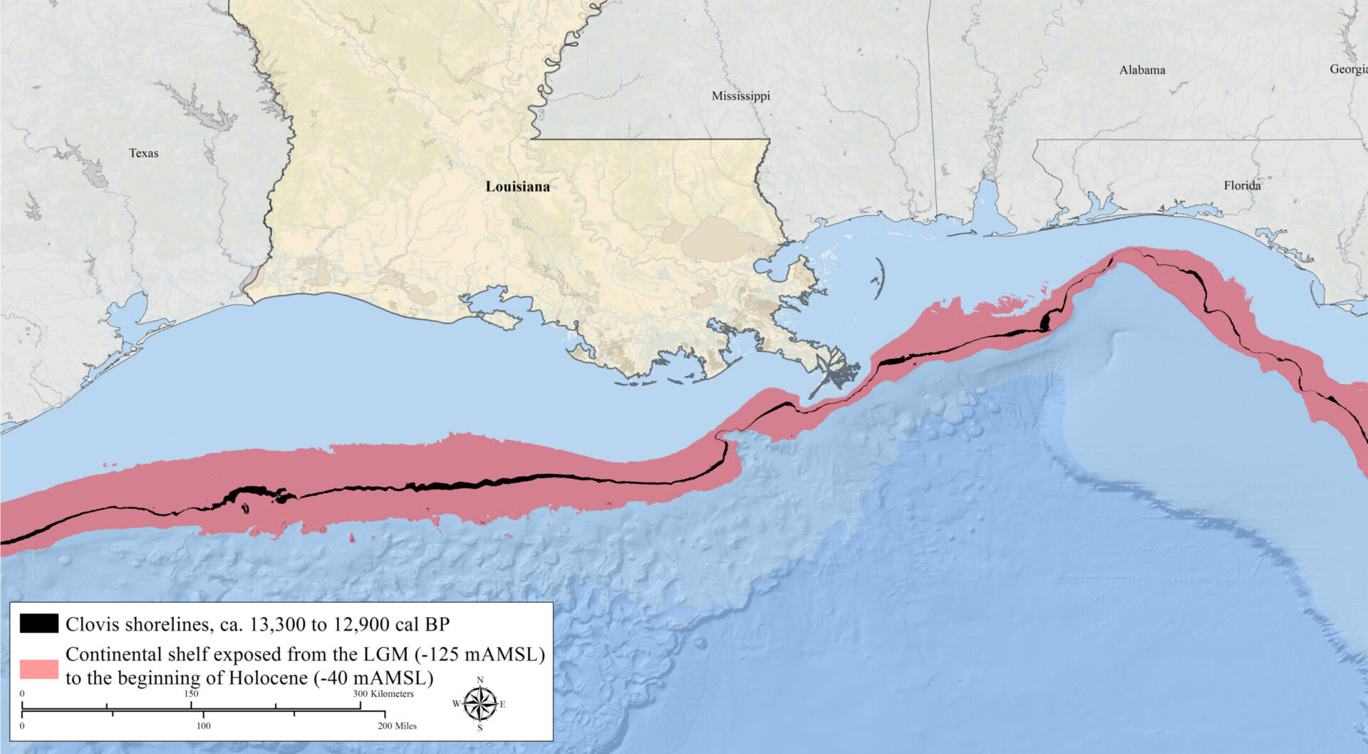
Map of the Clovis Shoreline
Between 12,900 and 13,300 years ago Louisiana's coastline stretched far deeper into the Gulf of Mexico
Courtesy of Thaddeus Bissett
Map of the Clovis Shoreline. Map by Thaddeus Bissett
Additional Data
| Courtesy of | Thaddeus Bissett |
| Date | 9500 BCE–8800 BCE |
| Copyright | Copyrighted |
| Disclaimer | The Louisiana Endowment for the Humanities has included this work on 64parishes.org for the purposes of criticism, comment, teaching, scholarship, educational research, and all other nonprofit educational usages under Section 107 of the U.S. Copyright Act. All rights reserved by Thaddeus Bissett. |