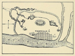
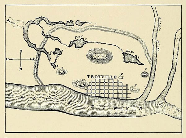
Map of Troyville Mounds & Enclosure
During the 1880s, the Bureau of American Ethnology's Division of Mound Exploration produced this survey of the prehistoric earthworks at Troyville (now Jonesville) in Catahoula Parish. The mound builders enclosed the hundred-acre site within an embankment more than ten feet high and ten feet wide.
Courtesy of Internet Archive
Map of Troyville Mounds & Enclosure. Henry Clyde Shetrone
Additional Data
| Courtesy of | Internet Archive |
| Date | 1930 |
| Copyright | Copyrighted |
| Disclaimer | The Louisiana Endowment for the Humanities has included this work on 64parishes.org for the purposes of criticism, comment, teaching, scholarship, educational research, and all other nonprofit educational usages under Section 107 of the U.S. Copyright Act. |