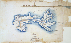
View of the Balise, Plan of the Mouths of Mississipi
Color reproduction of a map, “View of the Balise, Plan of the Mouths of Mississipi,” created by Barthelemy Lafon in 1814.
Courtesy of The Historic New Orleans Collection
View of the Balise, Plan of the Mouths of Mississipi. Lafon, Barthelemy (Cartographer)
Additional Data
| Courtesy of | The Historic New Orleans Collection |
| Date | 1814 |
| Copyright | Copyrighted |
| Disclaimer |
The Louisiana Endowment has included this work in 64parishes.org for the purposes of criticism, comment, teaching, scholarship, educational research, all other nonprofit educational usages under Section 107 of the U.S. Copyright Act. |
