Buried Histories at Evergreen Plantation
Homes used for centuries tell of their past residents’ lives
Published: August 29, 2022
Last Updated: March 22, 2023
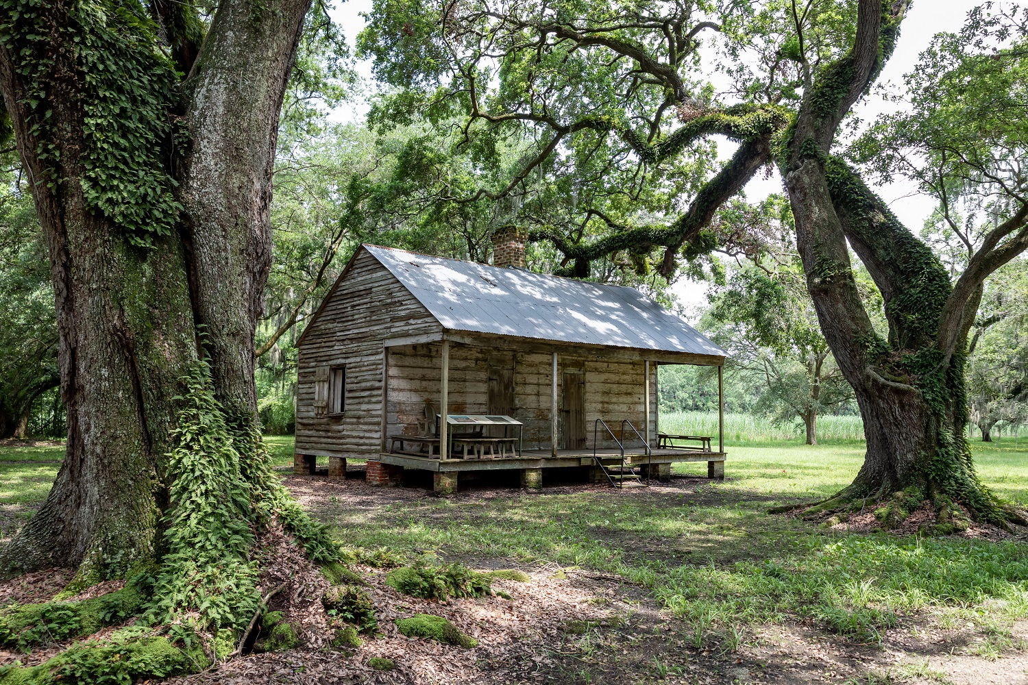
Photo by Sean Gasser
What first drew me to Evergreen were its twenty-two structures—twenty of which are doubled-sided cabins united around a central hearth. Two are larger structures, centrally located along the rows that run underneath an oak allée. What Evergreen presents, as an archaeological case study, is the study of 44 to 48 different households from 1800 to 1950. Each of the household structures are still located where they were constructed in the early nineteenth century. While they have been, like Theseus’s ship, continuously rebuilt and repaired for over a hundred years, their footings and footprints are intact. And to the best of our knowledge, based on testimony from the landowners and descendants, the archaeological contexts of the yards and spaces surrounding this community have not been machine plowed, graded, or disturbed. Therefore, we can attempt to reconstruct the lifeways and interrelationships of households and communities that lived through enslavement, the rise of the domestic slave trade, the Civil War, Reconstruction, and Jim Crow eras, up to the site’s abandonment just before World War II. Archaeology at Evergreen offers the potential to tell stories about the lives of individuals and communities whose histories have not been clearly told.
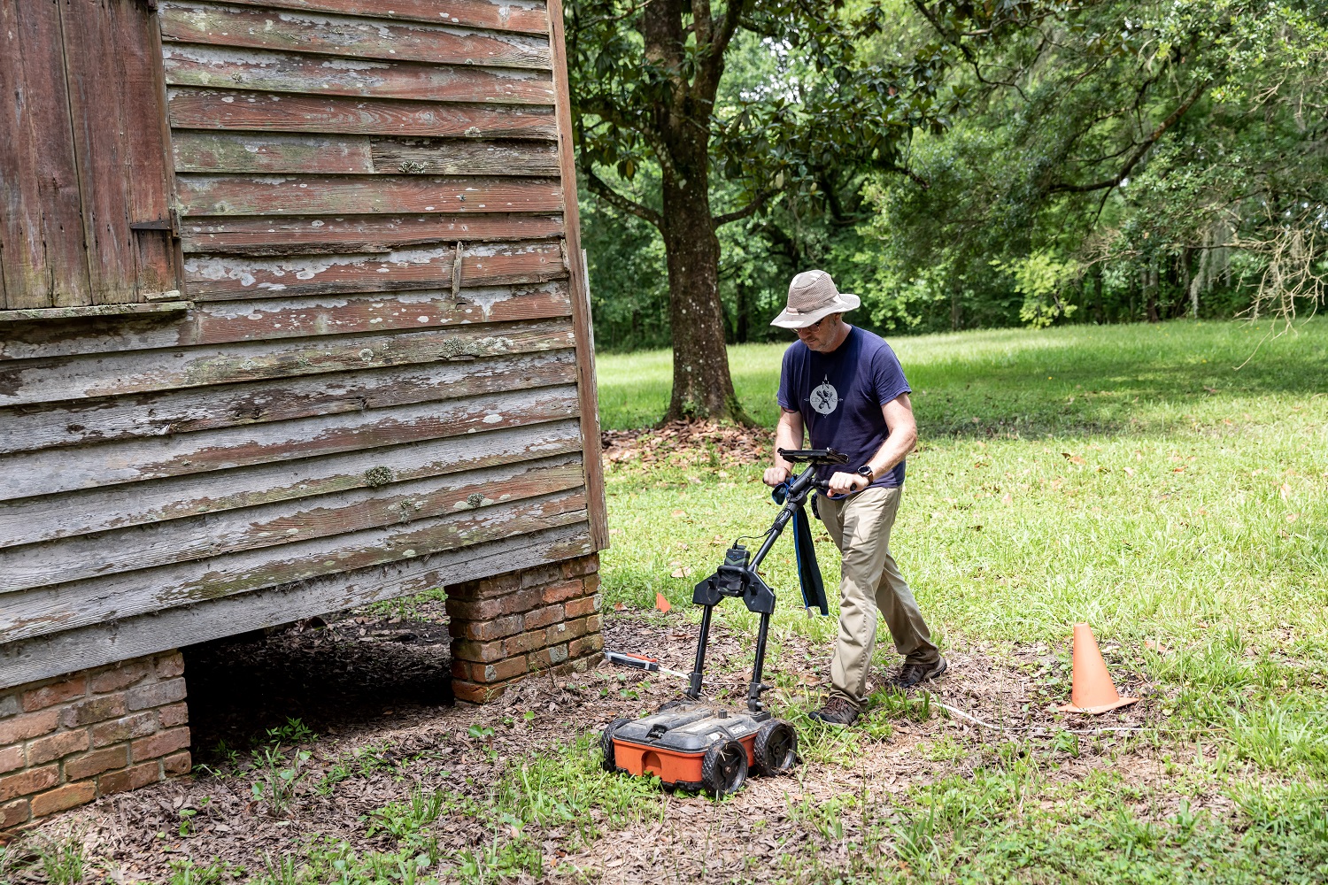
Bryan Haley, archaeologist and remote sensing specialist, uses a ground penetrating radar to look for buried architecture and building remains. Photo by Sean Gasser.
Evergreen is one of the hundreds of plantations that lined the Mississippi River during the French colonial, Spanish colonial, and subsequent American period up through the Civil War. Today, it stands apart as a National Historic Landmark, consisting of over forty different structures, including historic barns, pigeonnaires, and kitchens, and twenty-two quarters used to house the enslaved, and later, their freed descendants who continued working the sugar fields. With this designation, Evergreen has some protection from encroachment by developers and access to resources for preservation and restoration. Evergreen’s neighbor is the Whitney Plantation, a remarkable museum to African slavery and the German Coast Uprising. Both Whitney and Evergreen are extraordinary monuments, and their existence is a continual landmark to the lives of enslaved Africans, free people of color, and the Germans settlers who were enticed to come settle the newly formed Louisiana territory by John Law.
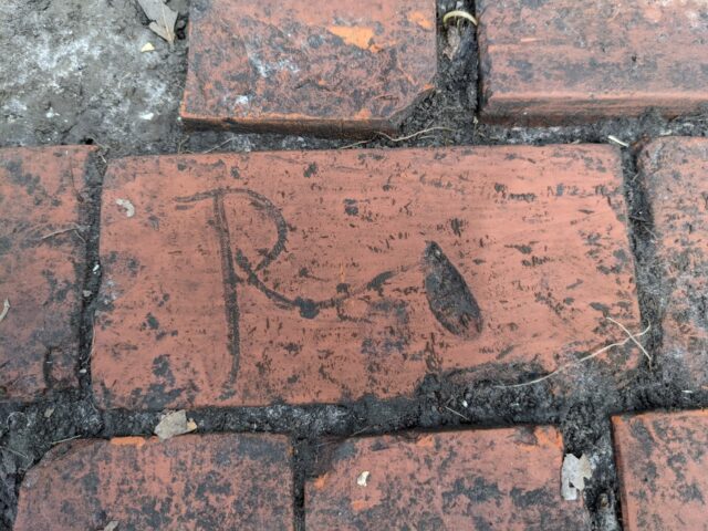
Engraved brick with fingerprint in the buried and previously “unknown” building. Jayur Madhusudan Mehta.
In the 1883 map made by Mississippi River surveyors, Evergreen Plantation had twenty-two structures near the sugar mill, and historical records indicate these structures were built in the early 1800s. This map does not show a church of any kind, and yet stories from descendants as well as oral testimony from the owners dating back to the late 1960s indicate there was another structure near the quarters area that was used as a church. Another testimony documented by the Natchitoches-based National Center for Preservation Technology and Training from descendant Lester Simon indicated the church may have been located elsewhere. My involvement in Evergreen came at the request of the site managers who wanted to know where the church may have been located. From their inquiries and my collaborations with colleagues and community members, the Evergreen Plantation Archaeological Survey was born.
Most modern archaeological projects begin with high-resolution spatial mapping and subsurface surveying using remote-sensing equipment, which allows archaeologists to detect buried sub-surface anomalies without excavation. Spatial mapping was accomplished using a combination of aerial photography, ground-based control points established using a total station, and GPS-based surveying equipment. For sub-surface mapping, we used ground-penetrating radar (GPR), which creates a 3D map of the subsurface using a radar signal and sensor array. With assistance from Bryan Haley of Coastal Environments Inc., we surveyed the two fields just north of the quarters area at Evergreen. This was the first phase of our GPR survey. In 2021, with support from the Louisiana Endowment for the Humanities, we returned to the site for phase 2 of our survey, and to survey over 95 percent of the entire area near the quarters, which allowed us to make subsurface maps of the front, side, and backyards of all the quarters, as well as the oak allé and surrounding areas. Phase 1 of our survey resulted in a map of geophysical anomalies—potentially, buried cultural features—that appeared worthwhile to investigate with shovel tests and excavation units.
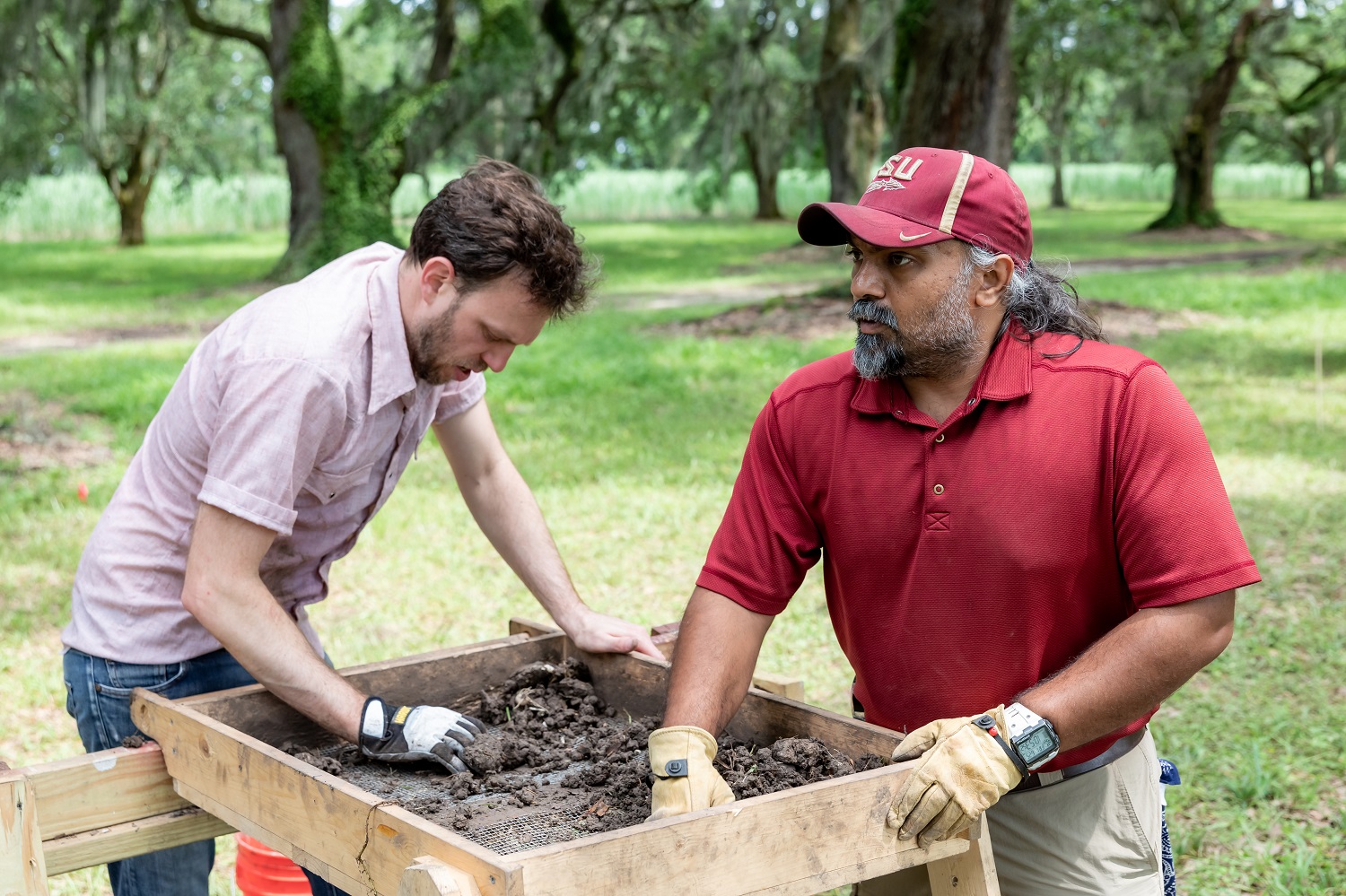
Brian Ostahowski (left), archaeologist and cultural resource specialist, and Jayur Mehta, archaeologist with Florida state University, sift through dirt at the archaeology site at Evergreen Plantation. Photo by Sean Gasser.
With students and colleagues from Florida State University, Tulane University, and the Isidore Newman School, we investigated anomalies in the field north of the quarters, finding buried broken bricks, shards of window and glass bottles, sherds of broken pottery dating to the nineteenth and twentieth centuries, cut and wire nails, glass marbles, buttons, and one broken kaolin pipe fragment engraved with the letters “GO.” In one of our excavation units, we found a brick engraved with the letter “R” and marked with a fingerprint. That brick, along with a set of other bricks like it, were part of the base of a double-firebox chimney that we found buried approximately 15 to 20 cm below the ground surface. This was our significant find of the summer, a buried firebox, probably once part of a building quite like the other quarters at Evergreen, but that had never been identified before. Most importantly, we found a crucifix buried in one of our units that was likely used in that building as part of religious ceremonies and rituals.
We will have to go back, of course, and look for the edges of the building, and find some footings—other pieces of architecture that indicate how big the building was. We are also analyzing and describing artifacts from this structure, which will give us a better understanding of how this building was used. The brick feature and the crucifix support the idea that the entire quarters area is a sacred place. This finding also shows us that even sites with no standing architecture can be archaeologically significant. Almost any plot of land along this historically significant corridor has the potential to hold irreplaceable historical and culturally relevant archaeological records, which is why industrial development along the West St. John corridor has the potential to be so damaging. This eleven-mile stretch of land is lined with numerous archaeological sites, historical sites, and communities threatened by environmental decline, climate change, and industrial development.
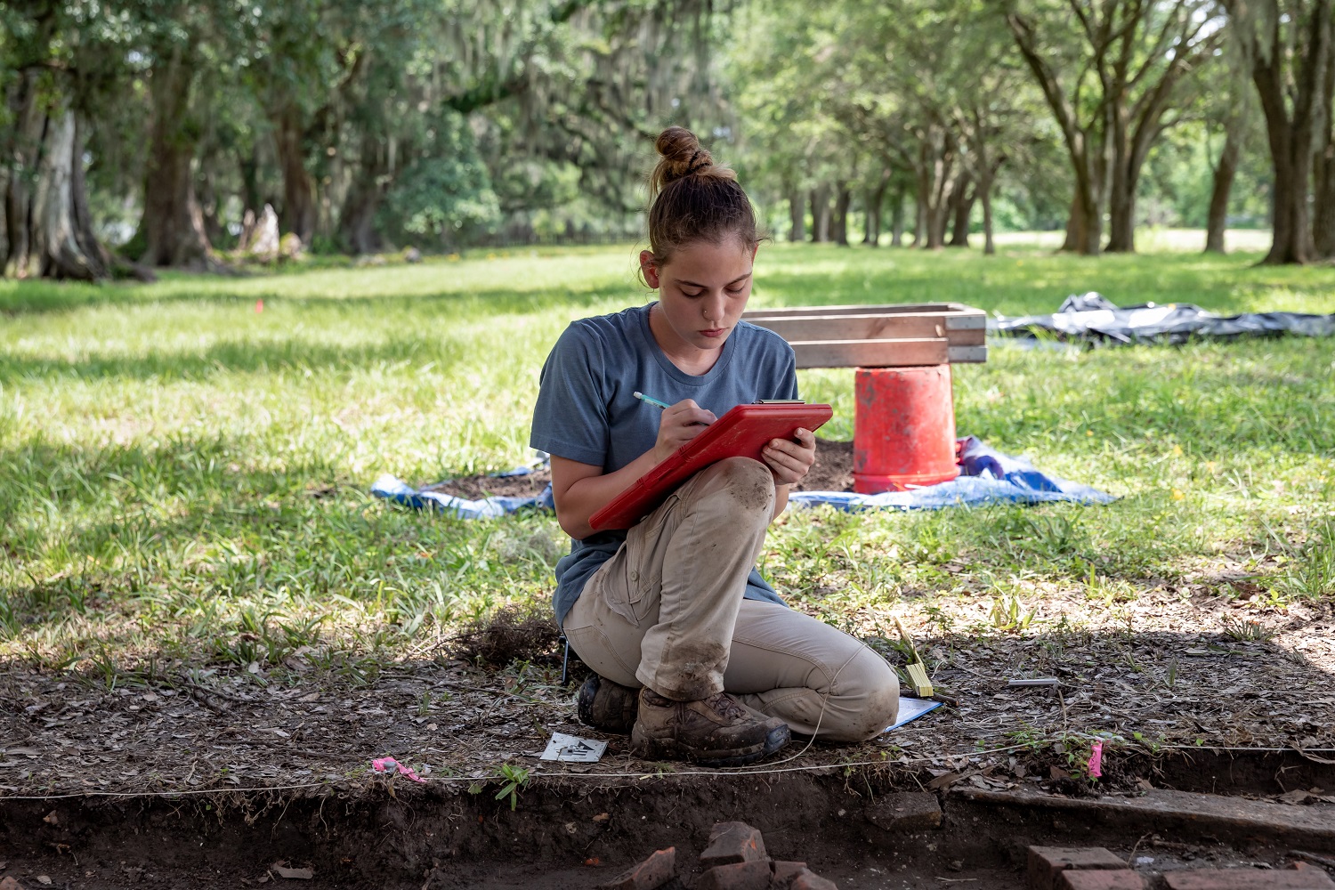
Makenna Chandler, a FSU grad student in archaeology, measures and takes soil samples at dig site at Evergreen Plantation. Photo by Sean Gasser.
The Evergreen Plantation Archaeological Survey is a new project and a new direction for me. It is also a collaborative endeavor with scholars Alisha Gaines from Florida State and Natalie King-Pedroso from Florida Agricultural and Mechanical University, a historically Black institution. What is most exciting about this project is the opportunity to be in the field with students learning in an interdisciplinary manner about African American history and the history of the sugar-producing plantation south. Beyond the archaeology of these households, it is exciting to be connected to descendants who want to come visit and to talk about their memories as children, living in the quarters that once housed enslaved and free folks. On one particular visit, Lester Simon came by with his family, and he talked about playing marbles as a child under the porch of one of the structures with his friend. That same day, collaborators from Florida State found several glass marbles while collecting in the fields behind the quarters. Could it have been Lester’s, long lost for so many decades? It was certainly some young child’s toy, lost in the dirt, and found again, by two women looking to tell new stories. What archaeology at Evergreen can tell us is that history is everywhere, all around us, buried under the earth, and resting on the surface. We merely have to open our eyes.
Dr. Jayur Madhusudan Mehta is an assistant professor in anthropology at Florida State University, specializing in the study of North American Native Americans, human-environment relationships, and the consequences of French and Spanish colonization in the Gulf South. He is currently lead investigator for the Evergreen Plantation Archaeological Survey (EPAS) and Resilience in the Ancient Gulf South (RAGS), an interdisciplinary investigation into delta formation, hunter-gather settlement dynamics, and monumentality in the Mississippi River Delta region south of New Orleans.
