Magazine
As It Stands
New Orleans design firm CICADA makes a thorough map of present-day Grand Isle
Published: June 1, 2026
Last Updated: June 1, 2026
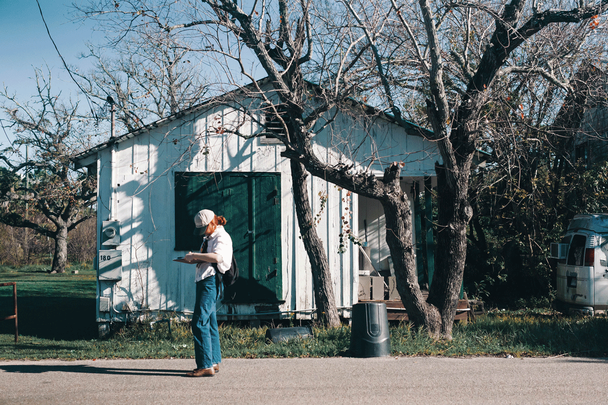
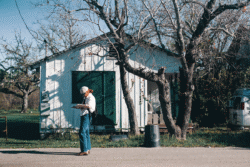
Photo by Catherine Restrepo, courtesy of New Orleans design firm CICADA
Allyson Hinz, staff preservationist for CICADA, conducts a survey of standing structures on Grand Isle.
You may have taken a snapshot of Grand Isle before—sandy toes, palm trees, that unbelievable marlin. Your vacation ends and you walk off with a memento from your time on Louisiana’s only inhabited island outpost.
For the architects and students who milled across the island this past January, a snapshot of Grand Isle entails drones, GIS mapping, field observations, and spreadsheets. Their goal, as they walked the 7.5-mile length of the island over the course of a week, was to capture data on the more than two thousand buildings on Grand Isle today. “We conducted an architectural documentation survey of every single standing structure on the island,” said Allyson Hinz, staff preservationist for New Orleans design firm CICADA. “So that included the historic resources, it included non-historic resources, it included anything from a cell phone tower to the oil presence that is on the island with Exxon and Shell.”
The project is funded by a grant from the State Historic Preservation Office through the National Park Service, with the goal of a baseline documentation of island resources to support future planning and funding opportunities. CICADA, in a project team led by Hinz and Matt DeCotiis, worked along with Dr. Heather Veneziano, program director for Tulane School of Architecture and Built Environment’s historic preservation program and founder of preservation consulting firm Gambrel and Peak. The information gleaned from their weeklong intensive has been channeled into Louisiana Historic Resource forms for each and every structure. Artificial intelligence has streamlined the data migration from map to form, but it’s up to Veneziano’s cohort of graduate students to scrutinize all the submissions for accuracy. The team’s drone photography of the whole island provides a helpful additional perspective.
“We have all this quantitative information in our GIS map right now,” said Hinz. That data will then be used to build a story map, publicly accessible as a tool to learn about Grand Isle, past and present. “It will be immersive, so that any person can go to it and learn about the island and learn about all the individual resources that are there.”
Grand Isle has many stories to tell. Devastating storms have pushed the island to reinvent itself over the centuries.
Grand Isle is only recently, if now granularly, familiar to Hinz. The Iowa native graduated from Tulane with a master’s degree in historic preservation in 2025. While in school, she began to work with the nonprofit Restore Grand Isle to place the Oleander Hotel (ca. 1931) on the National Register of Historic Places. The Oleander is a lonely relic of the island’s resort era, and with the tax credits available through its National Register status (made official in summer 2025), Restore Grand Isle plans to renovate the long-empty hotel as a visitor and cultural center.
Grand Isle has many stories to tell. Devastating storms have pushed the island to reinvent itself over the centuries. In assessing the buildings that have lasted, even a cursory glance tells the architects what has worked. “You go to look at these historic structures that were either built in the latter part of the nineteenth century, or in the early twentieth century. They’re as elevated as homes are here in New Orleans, at about three feet, and they’re still existing. It has to do with the quality of construction, and the fact that they are on a natural ridge there in the center of the island,” said Hinz.
How a building has been modified or fortified provides a visual record of the island’s environmental history, from asbestos siding used in mid-century alterations after Hurricane Betsy to metal reinforcements that promise resilience on modern fishing camps.
Hinz and the team also took ample time to get to know the people who inhabit these buildings. “As part of our research, Allyson and a few other team members went and interviewed people that live on the island, people that spend a lot of time there, the government [entities] like the mayor,” said DeCotiis. “They really dug into the people, not just the structures of the place. That’ll add a lot of context to our story maps as we go forward. So it’s a multi-layered approach. We’re trying to tell the story of who lives there.”
“Grand Isle feels like it exists on the edge of the world,” said Hinz. “It’s pretty isolated from the mainland. On the outside it looks and feels almost like a tourist town. But if you spend enough time, talk to enough people, you’ll find there’s a very deeply rooted history and culture here.”
This detailed mapwork will help Grand Isle get on the record a sense of self and history that isn’t necessarily reflected in the state archives. “People on the island know where all the historic structures are,” said Hinz. “It’s probably double the amount the state thought. The community knew that but the state didn’t know that.” With this data comes funding opportunities and incentives for reactivating or rehabilitating areas.
The documentation project will wrap up this summer, and the resulting online map will share Grand Isle with a wide-ranging audience, from elementary school children to coastal researchers. It’ll take a designer’s mind to layer in the intangible essentials to knowing a place. “The people have Grand Isle have a very interesting sense of humor,” said Hinz. “They do understand the gravity of certain pressures—climate pressure, development, tourism. But they manage to be light about it, and they make a lot of jokes.”
Lucie Monk Carter is a writer and photographer in Baton Rouge.