Winter 2025
Bike Around the Basin
A proposed 187-mile trail uses levee tops as guide through the Atchafalaya National Heritage Area
Published: December 1, 2025
Last Updated: March 1, 2026
Courtesy of the Atchafalaya National Heritage Area
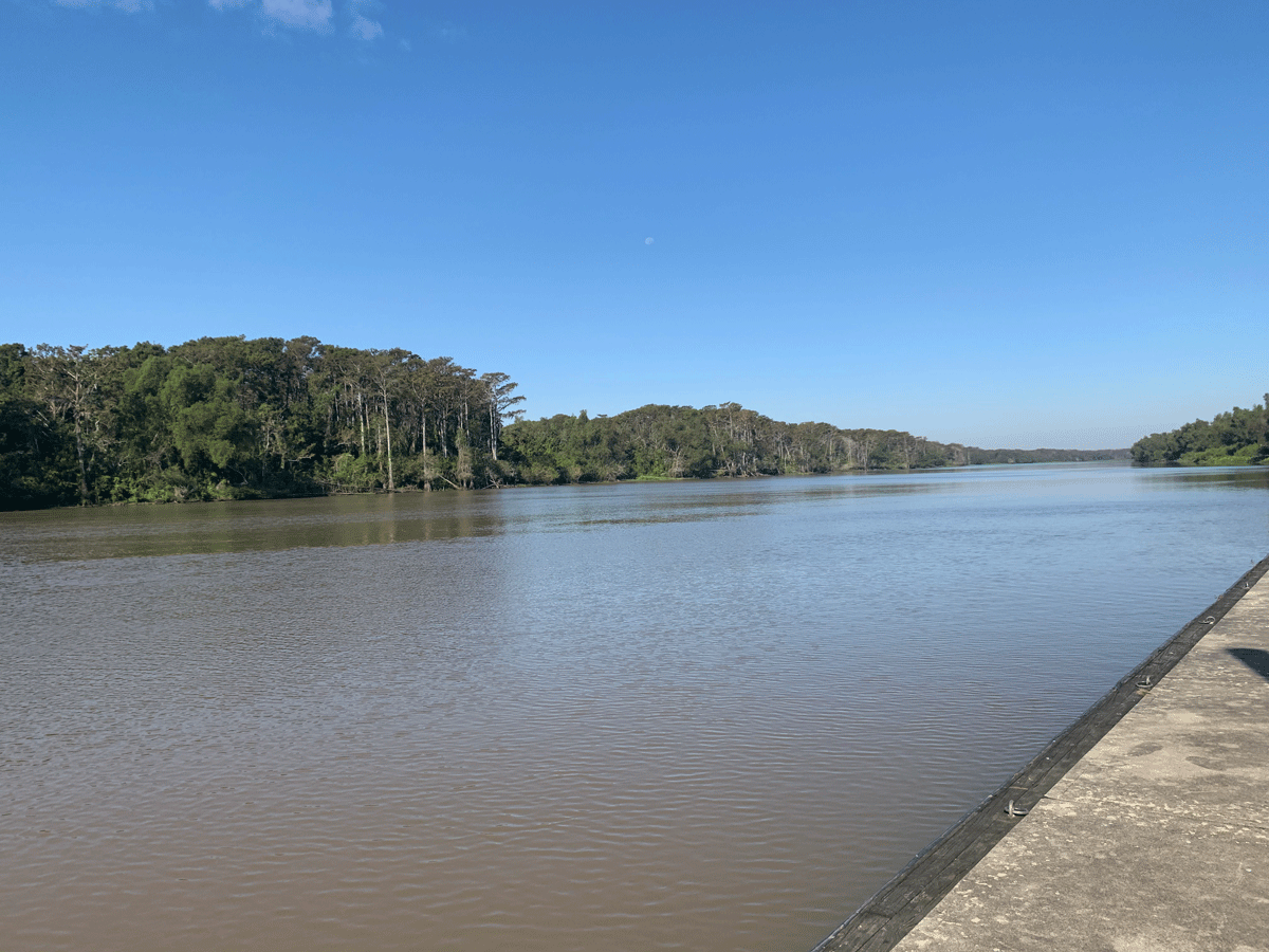
A potential trail site on the Atchafalaya River in Assumption Parish.
Planners for a new multi-use path tracing the Atchafalaya Basin levee sought feedback this past summer, meeting with residents throughout the parishes that the proposed 187-mile route would either connect or slice through, depending on your perspective. Pointe Coupee Parish is on the northern end of the path, before the route turns west through Avoyelles and heads back south through St. Landry. Several landowners who attended the open house at the Julien Poydras Center in New Roads were skeptical about the prospect. “We already have a bike path along False River, and no one uses it,” said one resident. Another used a Sharpie to write “No, FLOODING” over an area she knew to be troublesome. “I mean, there are cows that come up on that levee,” a woman told me as we pored over maps.
“Yes! One night in college,” I said, “I took a wrong turn trying to get to someone’s house on River Road and ended up driving on the levee! Soon I’m seeing cow after cow, and they did not like the headlights on my Corolla. Moooo, they said, moooo, as I tried to reverse . . .”
Her bemused stare indicated to me that most people, no matter how lost, manage to catch themselves before turning their sedans onto a levee-top. A bicycle is a different story.
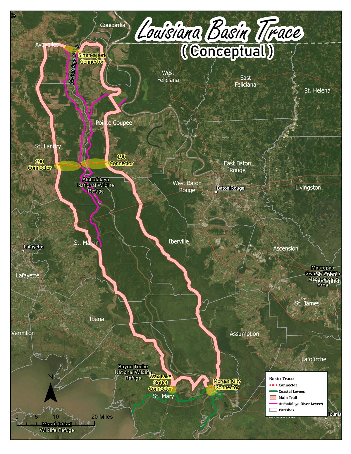
A conceptual map of the planned Louisiana Basin Trace bike trail.
The Louisiana Basin Trace, in its conceptual design, is a recreational path for cyclists and pedestrians linking the communities around the Atchafalaya Basin. The trail uses the levees as the basic structure; this engineered high ground has served to insulate humans from natural forces since the disastrous Mississippi River flood of 1927, and now could be a conduit for residents and tourists alike to immerse themselves in the region’s environment, through bottomland hardwood forests and past bald eagles and swallowtail kites.
The levees were constructed by the Army Corps of Engineers using easements; privately owned parcels remain so at the bottom of the levee, and while the levees themselves are public works, landowners often can manage access due to security and liability concerns. “The Corps has said this trail is possible. Now we’re seeing if it’s feasible,” said Justin Lemoine, a landscape architect and past director of the Atchafalaya National Heritage Area (ANHA), now the deputy assistant secretary at the Louisiana Office of Cultural Development. The distinction between possible and feasible is that a feasible trail has the resources and interest to be imminently accomplished. The feasibility study, conducted by the Acadiana Planning Commission, would be completed in early autumn 2025. Lemoine, Programs Director Collin Lindrew, and current ANHA Director Caroline Byrne Cassagne were traveling the region to facilitate public engagement throughout the summer. While ANHA conducted the feasibility study, the implementation of the proposed trail would be the responsibility of more localized efforts.
Cassagne found the landowner feedback illuminating. “Some people were adamant about not having cyclists on their property, but we worked through it. Once they got comfortable and understood the goals of the project, we got some interesting insights.” Two farmers she spoke to at the open house pointed out various issues, including the roving cattle and occasional careless hunter. “Then they got quiet and one said, ‘You know there’s a road alongside the levee there, internally.’ We had no idea. If we had moved forward without this public piece, we wouldn’t have gotten that feedback.
“It’s easy to look at projects like this and say ‘Hey, there are people who really want the connectivity, and there’s the landowners who don’t.’ It’ s not really that. Moreso, they’re saying, ‘This is a good idea, but let’s workshop it.’”
“I think everyone’s trying to encourage recreational cycling. It’s good for the communities too. Once you start linking things up, everyone benefits.”
The Atchafalaya National Heritage Area formed in 2006 to promote and interpret the culturally and ecologically rich area. Just last year, Lafourche was added, making fifteen parishes in the region’s purview. “It adds a really good energy, I think,” said Cassagne. She also cites the ANHA’s Water Trail, a self-guided route of fifty sites, as a powerful way to understand the impact of water on the area—and an opportunity to get kids out of the house and on the regional roads. The Basin Trace will be one more strategy to foster and perpetuate a culture that might otherwise disappear into an increasingly homogenous world.
“This is not to encourage development. Many people here want to sustain a rural way of life. The intent is that it spurs economic activity, though,” said Lemoine. “These cyclists that are coming in will pull off, eat somewhere. They might stay at a B&B or a motel. There’s snacks, trips to the stores for supplies. These are tourists that are here for a recreational space.
“I think everyone’s trying to encourage recreational cycling. It’s good for the communities too. Once you start linking things up, everyone benefits.”
“A lot of communities are seeing this as a way to get from point A to point B,” added Cassagne. “Many of these rural areas have minority communities, some of which are impoverished and the only mode of transportation they have is walking and biking. Outside of the recreational piece and getting people to see the basin, [the Louisiana Basin Trace] acts as a community empowerment tool.”
The big idea of a basin trail, said Cassagne, can be condensed down from something “broad” and “beautiful” into a new baseline of understanding for potential infrastructure projects along the path—“so that when we go in these communities, as these types of projects come up, we don’t have start from ground zero.”
Similar trails are being sketched throughout the state. Bike advocates in New Orleans are seeking ways to tie into routes as far west as Baton Rouge, as well as around Lake Pontchartrain to the Northshore, where the Tammany Trace connects five communities across thirty-one miles of former railroad corridor. The Delta Bike Trail stretches for 130 miles across northeast Louisiana, through Concordia, Tensas, East Carroll, and Madison parishes.
Like the Basin Trace, the Delta Trail has begun with a feasibility study to detail where the actual trail might squiggle from the conceptual design and identify possible funding sources for building out each segment. A Safe Streets and Roads for All Grant from the U.S. Department of Transportation has funded a transportation safety study for the region. “This would give us a ‘gold star’ with the federal transportation secretary, so that every grant application we submit going forward, they would pay attention to it,” State Representative Travis Johnson told the Natchez Democrat in 2024.
“We get approached by various groups and various parishes [to do trails],” said Cassagne. “But how do we make sure people are safe? What are liabilities? Who doesn’t want this? It can be a beast. So I think having this feasibility study [of the Louisiana Basin Trace] will make it less daunting for the people that do want to get that started. So it’ll be a resource, a good resource.” The path as proposed will adjust in response to the feedback, skirting the places of resistance or disinterest and flowing more freely where people are eager to see an increase in through traffic. “The levee tops just serve as a guide. It’s where our story begins, really,” said Cassagne. The parishes that form the circumference of the basin have a new opportunity to attract visitors, waving in weary cyclists with the promise of a cultural demonstration or just a protein bar from a local grocery store.
My route to New Roads for the open house had taken me from Baton Rouge up 190 to Highway 1, along the glittering False River. The houses were beautiful and the water inviting, but I’d only had glimpses as I sped past in my car. For my return home, I drove down the road alongside the levee, meandering like the Mississippi River. I had one destination, some too-convenient dinner to grab on the road, and a sleeping baby in the car seat. The “broad, beautiful” levee path ran parallel to my route and I imagined its future improvements and detours, the marker squiggles of input from citizens and planners that had just sullied a once pristine but abstract plan. Could it work? Not there, not there, but here’s an idea. Let’s see what this looks like… I found myself wondering how the air felt up there on the parallel road. I could feel it on my shoulders, could laugh at the cows as I pedaled past.
Lucie Monk Carter is a writer and photographer in Baton Rouge.
