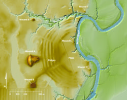
LiDAR Map of Poverty Point
Topographic lidar map of the Poverty Point World Heritage Site
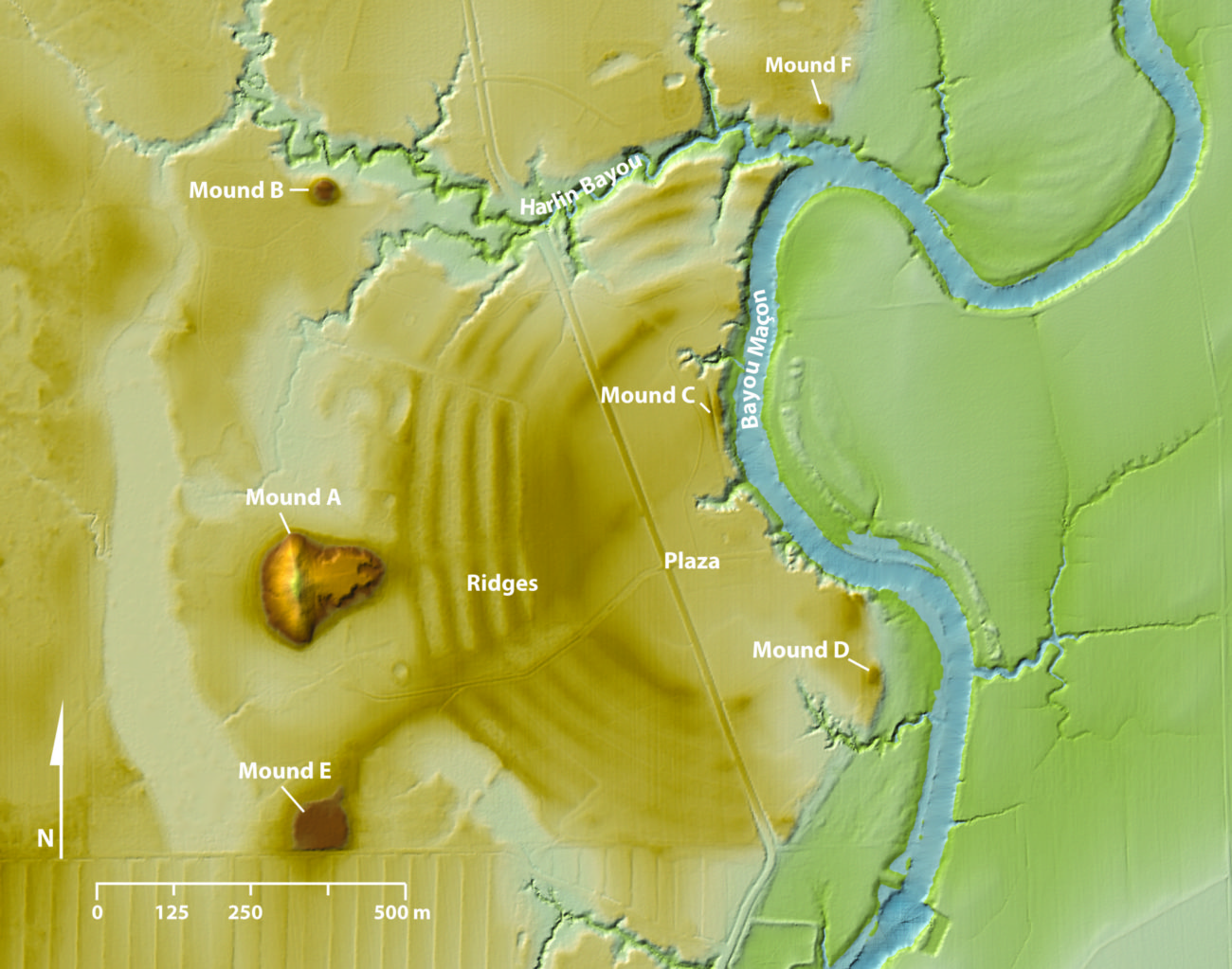
Courtesy of Poverty Point Station Archaeology Program, University of Louisiana at Monroe
LiDAR Map of Poverty Point. Map by Diana Greenlee
Additional Data
| Courtesy of | Poverty Point Station Archaeology Program, University of Louisiana at Monroe |
| Date | prehistory |
| Copyright | Copyrighted |
| Disclaimer | The Louisiana Endowment for the Humanities has included this work on 64parishes.org for the purposes of criticism, comment, teaching, scholarship, educational research, and all other nonprofit educational usages under Section 107 of the U.S. Copyright Act. All rights reserved by Poverty Point Station Archaeology Program, University of Louisiana at Monroe. |