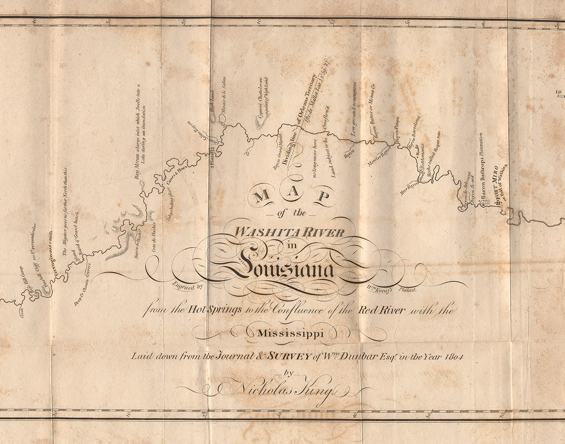
Map of the Washita River in Louisiana, 1804
This map was created in 1804, the same year that President Thomas Jefferson requested that Dr. Thomas Hunter and William Dunbar lead an exploration and documentation on the lower regions of the Louisiana Territory.
Courtesy of Library of Congress, Geography and Map Division
Map of the Washita River in Louisiana, 1804. Phillips (Publisher)
Additional Data
| Courtesy of | Library of Congress, Geography and Map Division |
| Date | 1804 |
| Copyright | Public Domain |
| Disclaimer | The Louisiana Endowment for the Humanities has included this work on 64parishes.org for the purposes of criticism, comment, teaching, scholarship, educational research, and all other nonprofit educational usages under Section 107 of the U.S. Copyright Act. All rights reserved by the Library of Congress. |