Hurricane Camille
When Hurricane Camille made landfall in 1969, it devastated communities and caused widespread damage to Louisiana’s oil and gas infrastructure.
This entry is 8th Grade level View Full Entry
National Oceanic and Atmospheric Administration
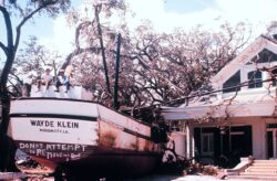
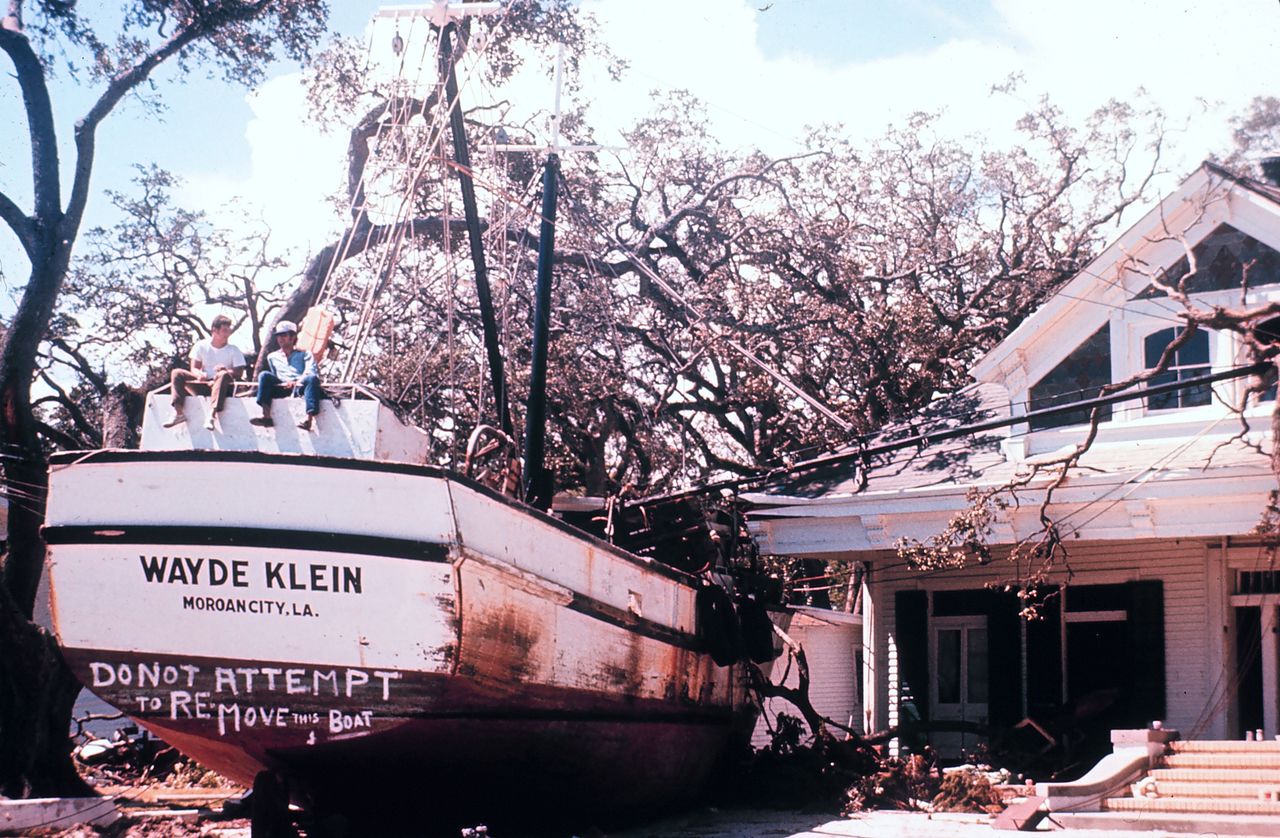
Aftermath of Hurricane Camille, 1969.
An intensifying Gulf storm alarmed Louisianans in August 1969. On August 17, Camille struck Bay St. Louis and Pass Christian, Mississippi, with the worst intensity the Gulf Coast had ever experienced in its tropical weather history. The Gulf Coast suffered catastrophic damage from Camille’s winds, rain, and storm surge. Though the Mississippi Gulf Coast sustained heavier damage, Camille’s impact on Louisiana was significant. In Louisiana there were 259 deaths, two thousand injured, and $1.42 billion in damages ($10 billion in 2020).
How destructive was Hurricane Camille in Louisiana?
Four years before Camille, Hurricane Betsy devastated Louisiana with $1.42 billion in damage ($10.2 billion in 2020). Louisiana residents worried about whether their storm defenses were ready. Broken levees near the Industrial Canal in New Orleans had been repaired, but weaker links remained. Efforts to stop flooding in some coastal parishes and along the Mississippi River were also not yet completed. Many residents were still updating their properties and rebuilding after Betsy.
Red Cross shelters opened across Louisiana, Mississippi, and Alabama in preparation for the large storm intensifying in the Gulf. As Camille approached the mouth of the Mississippi River, forty-six shelters were set up in New Orleans. The storm missed a direct hit on Louisiana, passing just right of the Mississippi River. However, it did damage the state’s eastern coastal and Florida Parishes.
Orleans and Jefferson Parishes suffered relatively light impacts, including power outages, flooding, and wind damage. In New Orleans’s Lower Ninth Ward, a levee break in the Industrial Canal looked eerily similar to breaks that happened during Hurricane Betsy. As water poured in from a levee break on the lower side of the canal, eleven police buses, a fire department flotilla, and thirty-eight National Guard trucks evacuated residents to shelters. According to the Times-Picayune, efforts to fix the canal break began immediately, “with crews containing the break in the levee on the downtown side of the canal shortly after the storm-driven water began going over the levee.”
Areas south, north, and east of New Orleans weren’t so lucky. The damage was catastrophic in five Louisiana parishes, including Tangipahoa, Plaquemines, St. Tammany, St. Bernard, and Washington. Four of the parishes were declared federal disaster areas by then-President Richard Nixon.
Storm surges spilled over the newly completed Mississippi River Gulf Outlet in St. Bernard Parish. In Yscloskey, Reggio, Shell Beach, Bayou Terre aux Boeuf, and Delacroix Island, the Times-Picayune reported that roofs were “wind-mutilated and, in some cases, gone altogether.” In Hopedale 80 percent of homes were damaged.
Plaquemines Parish was hardest hit because it’s on the coast and vulnerable to floods from overtopping of both river and coastal levees. Winds in the area reached up to 100 mph. Twenty-six miles of land between Empire and Venice were devastated by a Mississippi River levee break caused by surging storm water. “It made Betsy and the 1915 storm seem like child’s play,” an Empire resident told the Times-Picayune. The same resident also called the levee system “a death trap,” since people were trapped between two bodies of water. Governor John J. McKeithen agreed with the assessment. “It’s utter devastation,” he reported to the Times-Picayune a day after viewing the damage.
Governor McKeithen also noted destruction in the Florida Parishes between Slidell and Bogalusa. In Bogalusa, for example, at least five hundred trees were scattered across the city, and the National Guard was called out to prevent looting in the aftermath. Meanwhile, one hundred ten thousand residents lost power due to rain-soaked trees that, according to the Times-Picayune, “popped power lines” in areas like Angie, Bush, Pearl River, Lee’s Creek, and Varnado.
What were the long-term effects of Hurricane Camille?
Camille impacted natural wildlife as well as the agriculture and petrochemical industries. Citrus crops in Plaquemines Parish were destroyed when trees were ripped out of the ground. Many cattle, deer, fish, and alligators drowned due to flooding. But the largest business-related impact of Camille was damage to the state’s petrochemical industry. The storm closed about four thousand oil wells, and heavy equipment losses were sustained. Shell, Humble and Gulf, Chevron, Getty, J. Ray McDermott Co., and other petrochemical companies struggled to get workers back to damaged drilling sites due to dangerous working conditions. Camille’s $100 million damage (in 1969 USD) to the region’s oil and gas industry closed a decade of extremely costly hurricanes for the petrochemical industry. The environmental cost due to oil slicks from affected petrochemical operations is unknown.
Camille left some ten thousand Louisianans homeless in Plaquemines and the Florida Parishes, but the storm’s impact is mostly remembered for its destruction on Mississippi’s coast. As of 2020 there is no marker to commemorate Camille in Louisiana. But some residents still remember Camille as the last “big one” until Hurricane Katrina in 2005. However, a lasting effect of Camille on Louisiana is the continued use of the Saffir-Simpson Hurricane Wind Scale, which was implemented to measure sustained wind, size, and rain outputs after Camille. Perhaps appropriately, Camille was the first designated “Category 5” storm.