Morganza Spillway
The Morganza Spillway in Louisiana is a component of the flood control system for the lower Mississippi Rivier.
Wikimedia Commons.
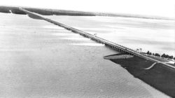
An aerial view of the Morganza Spillway when it first opened in 1973. It was created to control flood waters from the Red and Mississippi rivers.
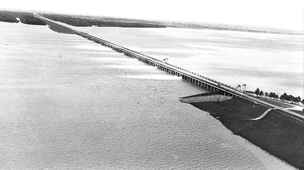
The Morganza Spillway is a major component of the flood control system mandated by the Flood Control Act of 1928 for the lower Mississippi River. It was designed to channel floodwaters from the Red and Mississippi rivers into the Atchafalaya Basin. Extending southward for twenty miles from the town of Morganza, the spillway joins the Atchafalaya Basin Spillway, which runs south to Morgan City, where excess water can be discharged into the Gulf of Mexico. With an average width of 5.3 miles, the Morganza Floodway below the Spillway itself can move six hundred thousand cubic feet of Mississippi River floodwaters per second, and its guide levees protect more than one hundred square miles of farmland in upper Pointe Coupée Parish. The control gate at Morganza rises thirty feet above the spillway and is almost four thousand feet in length. It consists of 125 bays, each twenty-one feet wide, in a concrete structure supported on piles; the bays are equipped with steel vertical-lift gates operated by gantry cranes. A highway-railroad bridge crosses the control structure. The US Army Corps of Engineers is responsible for operation and maintenance of the spillway and the control gate.
Since its completion, Spillway bays have been opened twice, in 1973 and 2011. The seventeen bays opened in May 2011 carried water from excessive Spring rains and northern snow melt.
Adapted from Karen Kingsley’s Buildings of Louisiana, part of the Buildings of the United States series commissioned by the Society of Architectural Historians (www.sah.org) and published by Oxford University Press.