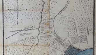
Plan showing the boundaries of the great conflagration of New Orleans on the 21st of March 1788
Architecture

An illustrated map showing the boundaries of the great conflagration of New Orleans on the 21st of March 1788. Settled parts of the town are illustrated with darker shading. This map also indicates where fire started and which buildings escaped the fire.