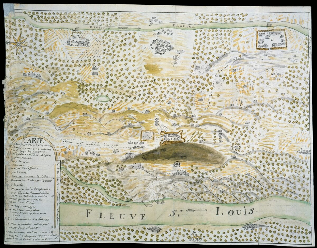
Map of Natchez and Surrounding Area
This map from around 1750 depicts the settlement of Natchez and the surrounding area, including Fort Rosalie.
Courtesy of Newberry Library
Map of Natchez and Surrounding Area. Jean-François Benjamin Dumont de Montigny
Additional Data
| Courtesy of | Newberry Library |
| Date | 1750 |
| Copyright | Public Domain |
| Disclaimer | The Louisiana Endowment for the Humanities has included this work in 64parishes.org for the purposes of criticism, comment, teaching, scholarship, educational research, all other nonprofit educational usages under Section 107 of the U.S. Copyright Act. The work is in the Public Domain. |