Geographer's Space
Ellicott’s Line
How the 31st parallel shaped Louisiana
Published: June 1, 2020
Last Updated: September 1, 2020
Special Collections, Howard-Tilton Memorial Library, Tulane University
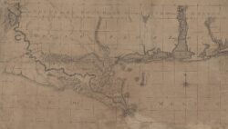
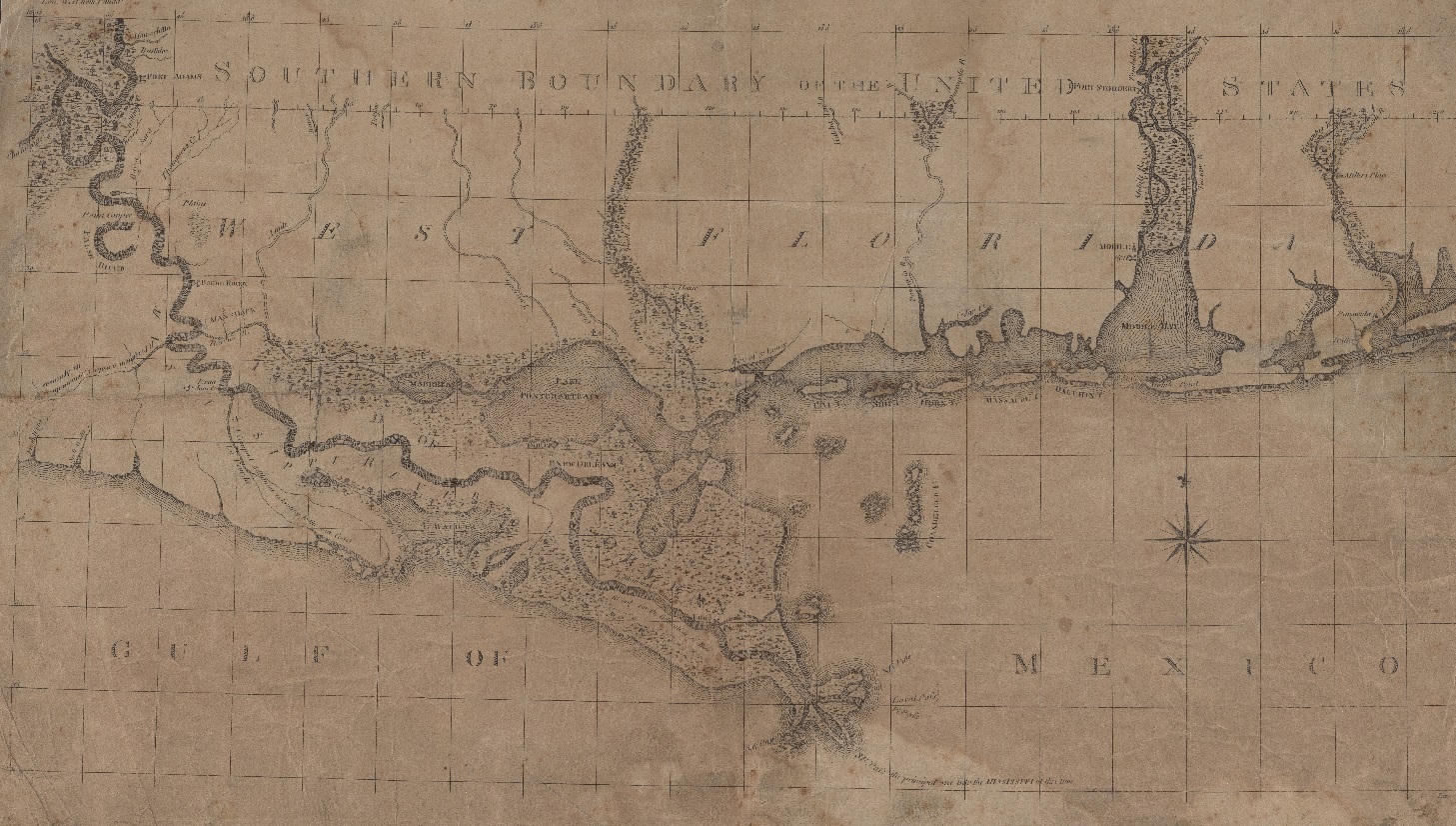
Southern Boundary of the United States from the Journal of Andrew Ellicott, 1803.
Where this arbitrary line came from, and how it got surveyed into the landscape, entails some understanding of imperial jockeying of two to three centuries ago.
Originally, the piney woods of the Florida Parishes were home to various petites nations, as the French perceived the local indigenous occupants. Tribes did not delimit their lands, but they did recognize territories. For example, when Iberville visited a native village along the Mississippi River in 1699, he understood that its red pole (bâton rouge) marked a nearby stream as the dividing line between the Ouma (Houma) and Bayogoula hunting grounds. It’s an early record of a sort of political border in this region, and it gave Louisiana’s capital its name.
Seventeen years earlier, René-Robert Cavelier, sieur de La Salle, laid claim to the entire Mississippi River Valley, which in his mind put French borders on the map. But no one at that time understood the extent of that watershed, and contemporary maps tended to be vague about interior borders. (In fact, only the western-most corner of the Florida Parishes actually drains into the Mississippi River; all other portions flow into the Lake Pontchartrain and Pearl River watersheds.)
The French and Indian War radically changed the emerging political geography. Foreseeing defeat to the British, the French secretly ceded everything west of the Mississippi to the Spanish, plus the “Isle of Orleans” east of the river. This made lands south of Bayou Manchac, Pass Manchac, and Lakes Maurepas and Pontchartrain, including New Orleans, part of Spanish Luisiana. Upon winning the war in 1763, the British took possession of nearly all other North American lands that had been French. Spain also took some losses, ceding its Florida colony to the British. That turned the Florida Parishes into British West Florida.
In the interest of regulating migration and managing discontented French and native inhabitants, the British put some new lines on their colonial maps. The Proclamation of 1763 established four separate jurisdictions, one of which was called West Florida, for which they selected the 31st parallel as its northern border. Why? This line’s whole-integer latitudinal enumeration made it convenient for the purposes of cartography and documentation. It aligned well with the British delineation of the East Florida jurisdiction, while encompassing key coastal waters and adjacent towns, thus assuring that Gulf access would be under British control.
Alas, the 31st parallel didn’t work on the ground. It gave British West Florida too little elbow room, and it excluded the vital river port of Natchez. So in 1764, the Brits moved the West Florida border up to latitude 32°22′ north, roughly where Jackson, Mississippi, is today.
For the next two decades, British West Florida occupied the swath between the 32°22′ line and Bayou Manchac, eastward through Lakes Maurepas and Pontchartrain. To the north was Choctaw, Creek, and Chickasaw territory, claimed but not controlled by the British; to the south and west was Spanish Louisiana.
Once again, war would change the map. The Treaty of Paris, which ended the American Revolution in 1783, made former British colonies into American territory, and turned British West Florida into Spanish West Florida.
The United States and Spain were on friendly terms at this time, but their diplomats disputed whether the new international border should be down along the 31st parallel (better for the United States) or up along the 32°22′ line (better for Spain). The 1795 Treaty of San Lorenzo, also known as Pinckney’s Treaty, put the boundary at the 31st parallel. Had the other line prevailed, Louisiana today might include all of southwestern Mississippi, making its shape more square than boot-like.
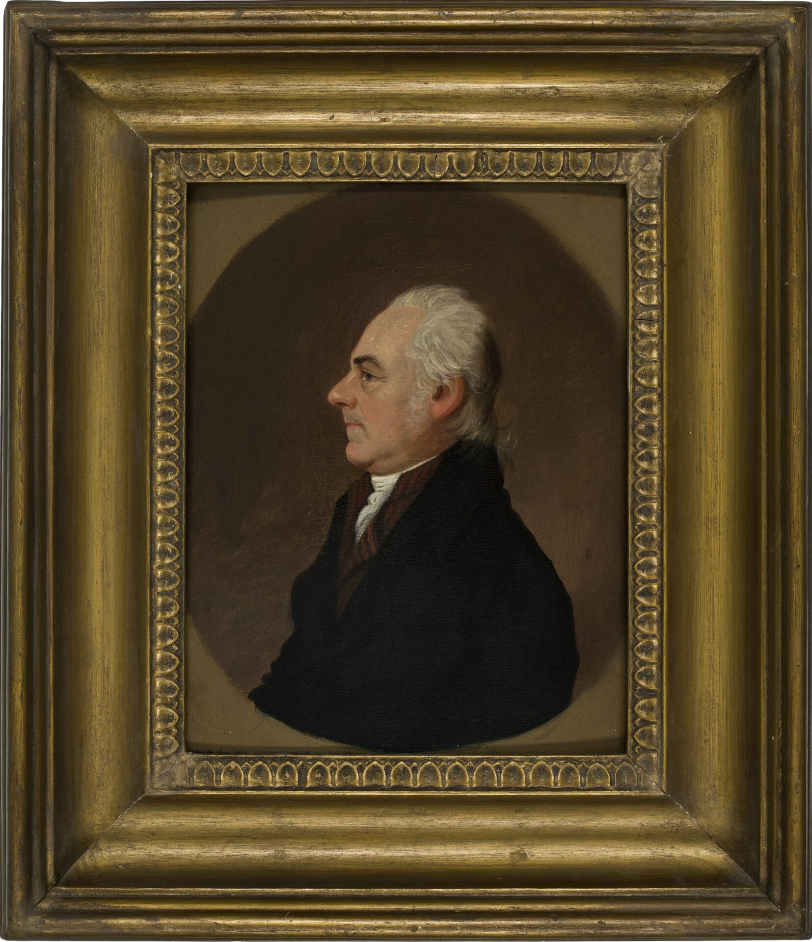
Andrew Ellicott by Jacob Eichholtz, 1809. Oil on wood panel.
New-York Historical Society, gift of Mrs. Thomas Clapham
With emigration expected into the region and orderly land-titling a concern, both parties deemed it necessary to survey the 31st parallel into the landscape. Leading the American effort was a Pennsylvania mathematician named Andrew Ellicott, who had surveyed a number of important state boundaries in the Mid-Atlantic region, including the Mason–Dixon Line and the plan for the District of Columbia. On May 4, 1796, President George Washington commissioned Ellicott to sail down to the southwestern frontier and, accompanied by a detachment of troops, survey the 31st parallel from the Mississippi River across four hundred miles of dense forest eastward to the Apalachicola River. The Spanish, meanwhile, had appointed William Dunbar and Stephen (Esteban) Minor to oversee the Spanish surveying crews.
Ellicott arrived in Natchez on February 24, 1797, only to be delayed a year by political wrangling with the Spanish commanders, who were reluctant to leave this new American territory. Finally, in the spring of 1798, Ellicott got to work, accompanied by American and Spanish crews.
The surveying process began with the establishment of astronomical field stations along the route, the first one being the most important. At Clarksville near present-day Fort Adams, Mississippi, Ellicott explained the experimental strategy of anchoring the boundary: “I set up the clock, and small zenith sector, and proceeded to take the zenith distance of [the star] pollux, for five evenings successively. . . . From the Result of those observations, it appeared that we were three miles . . . too far north. [We] traversed with a common surveying compass and chain, to the south, [to find] a proper place to encamp, to determine the first point in the line with accuracy.”
At subsequent stations, Ellicott would set up a shelter with an open view of the night sky. Using two large zenith-sector telescopes and a high-precision astronomical clock, he measured the angles traced by selected stars as they moved around the highest point (zenith) of the sky. The mathematician then corrected the figures for refractions, repeated the process nightly, compared the results to star charts, and calculated from these data the exact latitude and longitude of the station. Hundreds of such stations were established, starting in West Feliciana in the summer and fall of 1798, then over to the Pearl River, Mobile, and Pensacola in spring 1799, and into the Apalachicola region by year’s end. What resulted was an array of known latitude and longitude coordinates connecting the southern wilds to the mapped geodetic sphere.
After establishing each point came the task of measuring, by compass and chain, the 31st parallel as it crossed the landscape. Workers cut vegetation along the swath and erected mounds every mile. At one key spot north of Mobile, crews placed a stone that would later demarcate St. Stephens Meridian and the baseline for all public land surveys in Alabama and Mississippi. Known as “Ellicott’s Stone,” and still in place today, workers inscribed “U.S. Lat. 31 1799” on one side and the Spanish equivalent on the obverse. By early 1800, the astronomical measurements were complete, and the United States now had an established, mapped international border with Spain.
That same year, Spain secretly retroceded Louisiana to France, and three years later, France sold the colony to the United States. West Florida, not included in either deal, now formed a slender possession of Spain wedged between American soil and Gulf waters.
Many Anglo residents, who had settled in the western corner of the colony starting in British colonial times, were generally hostile to Spanish rule. In 1810, they rebelled to form the independent Republic of West Florida, its borders encompassing today’s eight Florida Parishes. After three months of factious turmoil, legally questionable diplomacy, and some violence, the tiny republic acquiesced to American occupation, pending further negotiations.
Spain, an empire in decline with bigger problems elsewhere, agreed in 1819 to cede all of Florida, from the Mississippi to the Atlantic, to the United States, and to redraw the two nations’ western boundary. Known as the Adams–Onís Treaty, the deal not only gave Louisiana the top of its “toe,” by annexing the Florida Parishes, but also the back of its “heel,” by designating the Sabine River as the state’s (and at the time the nation’s) southwestern border.
The Ellicott–Dunbar–Minor survey of the 31st parallel, shown to be less than eight hundred feet off from modern satellite-based measurements, remains evident today in the lines of properties, the edges of fields and forest, and the borders of six southern states. The 31st parallel also became the baseline for Louisiana’s two prime meridians, forming the X–Y grid to which every square inch of Louisiana is legally documented in terms of townships, ranges, and sections. It’s referenced in the paperwork of millions of house deeds and land titles, and appears distinctively on every map of the United States made over the past two centuries. The 31st parallel is, quite literally, a part of Louisiana life.
Richard Campanella, a geographer with the Tulane School of Architecture, is the author of Cityscapes of New Orleans, Bienville’s Dilemma, Bourbon Street: A History, The West Bank of Greater New Orleans, and other books. He may be reached through http://richcampanella.com, [email protected], or @nolacampanella on Twitter.