The Moncla Gap
Of rivers, shifts, and avulsions
Published: June 1, 2024
Last Updated: September 1, 2024
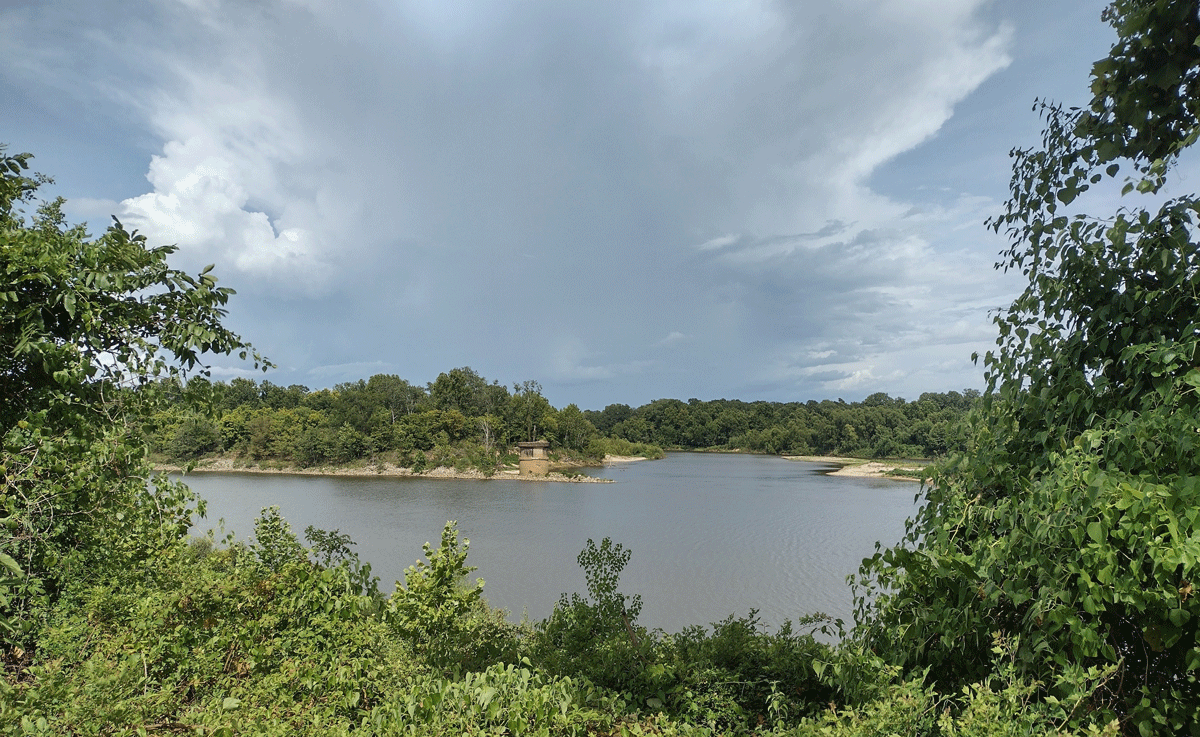
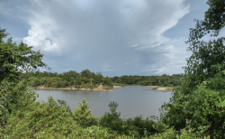
Photo by Richard Campanella
The Red River at Moncla Gap.
Lower Louisiana would have a very different geography—and history, economy, and culture—were it not for an obscure topographical feature in rural Avoyelles Parish.
It’s known as the Moncla Gap, and centuries ago, it enabled a radical shift in how runoff originating on the high Western plains made its way through Louisiana to the Gulf of Mexico.
Let’s back up a bit—about a thousand miles, and a few thousand years. Rainfall on the Llano Estacado, a vast mesa south of present-day Tucumcari, New Mexico, nearly five thousand feet above sea level, gathered in a channel that flowed eastward past Amarillo, Texas. All along, intermittent tributaries swelled the river’s volume and its Permian Age sediment load, giving it a ruddy color the Spanish called rojo, the French rouge, and the English “red.” Thus named, the Red River continued eastward to form today’s Texas–Oklahoma border. Its volume augmented as it drained the verdant Texarkana region, the river coursed southwardly through present-day Shreveport–Bossier City toward Alexandria, then veered down what is now Bayou Teche and emptied into the Gulf of Mexico in lower St. Mary and Terrebonne Parishes.
That’s not where the Red discharges today, nor the Mississippi. But some three to six thousand years ago, those two rivers’ mouths had merged and deposited vast quantities of alluvium at a pace faster than longshore currents of the rising sea could sweep them away. What resulted was a fluvial (river-dominated) delta in southcentral Louisiana, where the coastline extended dozens of miles outwardly from the higher terraces on which today’s Lafayette and Opelousas are perched.
In time the Mississippi River would develop a crevasse in its bank and avulse (jump) eastward, whereupon it would start building a new deltaic lobe in southeastern Louisiana. The Red, too, would avulse eastward—through that feature known as the Moncla Gap.
The Moncla Gap was a topographical gorge between two Pleistocene Epoch terraces forming the Avoyelles Prairie, along the eastern side of the Red River valley just north of present-day Marksville. A few thousand years ago, the Red had found its way around the two terraces—what some have described as the “Marksville Hills”—and wended eastward to join the Mississippi. Then, around two thousand years ago, the Red broke more forcefully through that gap between the two terraces, whereupon it established a more permanent channel into the Mississippi River.
Soon, the Red largely abandoned its old channel, leaving it to become today’s Bayou Teche, and formed a confluence with the Mississippi at Turnbull’s Bend. A few miles downstream, some water flowed out of the merged current and proceeded southward in what Indigenous people called Bayou Chaffalio, today’s Atchafalaya River distributary. Most waters, however, continued southeastwardly to become the Mississippi River channel of modern southeastern Louisiana.
What caused the Red River to avulse through the Moncla Gap? It could have been a series of massive freshets (high-water events), which, coupled with their erosive power, exceeded the height of the gap and poured over it like a weir. More likely, a role was played by an unusual attribute of the Red River: its propensity to form “rafts,” or logjams, in its Louisiana valley. “This entanglement of logs, vegetation, and sediments remained in place for at least a millennium,” write geologists Nalini Torres and Danny Harrelson in a 2012 chapter of Reconstructing Human-Landscape Interactions, “and altered the flow regime of the Red River, causing a complete change in its geomorphic character.” What resulted was a complex network of interconnected channels, each of which might seek their own outlets and form their own rafts. Because logs often jostled and collapsed, rafts constantly shifted, and the natural reservoirs (“raft lakes”) impounded behind them sometimes ruptured, which releases a pulse of high water (known as catastrophic flooding) capable of blowing through a low spot like the Moncla Gap. “Research has documented very few other known cases where Rafts exist in the world,” write Torres and Harrelson, “and there is no stratigraphic evidence of other, older Rafts in the geologic record.”
The Red River’s lunge down Moncla Gap would profoundly influence the physical and cultural geography of Louisiana. For one, it shifted vast quantities of fresh water, sediment, and nutrients to new directions, to the benefit of southeastern Louisiana and at the expense of land-building on the southcentral coast. Innumerable species of flora and fauna, both aquatic and terrestrial, would be impacted, as would humans in their movements and settlements.
For example, overland travelers seeking to cross the Red River gravitated to the Moncla Gap on account of its firm banks and narrow channel. By one account, a ferry operated here as early as 1804, when it was called Glass Landing, later Faulk’s Landing (1842) and David’s Ferry (1847). In 1859 a French-born immigrant named Dr. Joseph Thibault Moncla purchased 320 acres on both banks and took control of what was now the Moncla Ferry. Moncla’s sons built houses, a store, and a steamboat landing; later came a cotton gin, sawmill, and warehouses, as well as a church, school, and in 1896, a post office. Moncla became the closest Louisiana has to a “gap town,” a settlement sited at a topographic pass.
Elsewhere in the region, the Red–Mississippi confluence at Turnbull’s Bend and the logjams and raft lakes on the Red River all came to be viewed as impediments to navigation and economic development. Those blockages had so hindered vessels heading upriver that early French colonists could sail no farther than a hundred or so miles up the Red River from the confluence—which explains the siting of Natchitoches in 1714.
As western shipping interests called for a cut-off to be dug at Turnbull’s Bend, and as Louisiana interests called for clearing out the Red River, pressure mounted for the federal government to intervene. In 1831, Superintendent of Western River Improvements Captain Henry Miller Shreve dug a channel to cut off Turnbull’s Bend, as he would do for many other meander loops; each had the effect of straightening the Mississippi’s sinuous channel, speeding its velocity, and reducing travel time. They also meant that less water proceeded down the old part of the meander, which resulted in sedimentation. In the case of Turnbull’s Bend, the slackened flow silted up the severed section, which became aptly known as Old River, and the more clogged it became, the more Red River water veered down the Mississippi.
Why not down the Atchafalaya? Because another logjam acted as a dam on that distributary, and just like those farther upriver, this particularly immense raft was viewed as a severe hindrance to development. By one 1828 estimate, reported in the Baltimore Gazette and Daily Advertiser, “the enormous quantity of brush, trunks of trees, &c [had] gained at least one mile per annum,” and “back[ed up] the water upon the land for many miles,” making “a lake of what was before a prairie. The forests too . . . are often killed by the overflow of water, and after standing for a few years with their roots, submersed, the trees become rotten and fall,” adding more logs to the jam.
Enter again Captain Shreve and his snagboat Heliopolis, which, with its powerful steam-driven windlass (a type of winch), worked relentlessly during the 1830s to clear logjams and release raft lakes. The project opened up northwestern Louisiana and gave rise to Shreveport, which supplanted Natchitoches as the head-of-navigation port on the Red. As for the enormous logjam by Old River, it was removed by the state in 1839, thus opening up Atchafalaya River access into central and northern Louisiana.
Things would have played out very differently had the Red never fused with the Mississippi courtesy of Moncla Gap. Likewise, the century succeeding those circa-1830s interventions also would have played out differently, hydrologically speaking, because the replumbing efforts had unforeseen consequences. Once that Atchafalaya logjam was removed in 1839, the Mississippi’s waters found a shorter and steeper path to the Gulf southwardly down the Atchafalaya (142 miles), rather than southeastwardly past New Orleans and out Plaquemines Parish (fully 315 miles). As more water “chose” to go down the Atchafalaya, its channel widened to accommodate it, thus inviting more flow. By the mid-1900s, the Atchafalaya had tripled its share of Mississippi water, and had seized all of the Red’s. Scientists predicted that around 1975, the Father of Waters would avulse substantially, possibly entirely, and leave nearly half the state’s population without an economic lifeline—and in the case of New Orleans, without a source of potable water. Morgan City would become the new New Orleans, so to speak, while New Orleans would become Venice (Italy), and Venice (Louisiana) would become Atlantis.
Once again, the federal government intervened. Between 1954 and 1962, the US Army Corps of Engineers designed and installed the Old River Control Structure, a complex series of sills, weirs, dams, and inflow and outlet channels, which fixes the Mississippi and Atchafalaya water flow at a 70:30 ratio, preventing any further avulsion from the former into the latter. The Old River Control Structure ranks among humanity’s most Herculean feats of hydrological engineering, and while it primarily represents a corrective to prior human actions, the underlying geographical circumstances were set in motion thanks to the Moncla Gap.
As for the community of Moncla, the same topography that attracted Dr. Moncla to this site ended up subverting it. During the gubernatorial administrations of Huey P. Long and O. K. Allen, state engineers selected the narrow Moncla Gap as a logical pathway for an auto bridge. After its opening in 1934, the Moncla Bridge enabled motorists to whiz by the old ferry landing and bypass the community of Moncla, causing economic decline. In 1945 unusually high waters came down the Red, and on April 12, the Moncla Bridge crashed into the Moncla Gap. A replacement was eventually built a mile upriver, but by then, Moncla had become what it is today: a verdant hamlet set among fields and forests, with a Catholic church, a community center (and theater!), and a historic plaque.
Richard Campanella, a geographer with the Tulane School of Architecture, is the author of Draining New Orleans (LSU Press, 2023), The West Bank of Greater New Orleans, Bienville’s Dilemma, and other books. He may be reached at richcampanella.com, [email protected], or on Twitter @nolacampanella.