Unpeopled Louisiana
Mapping remoteness
Published: December 1, 2021
Last Updated: February 28, 2022
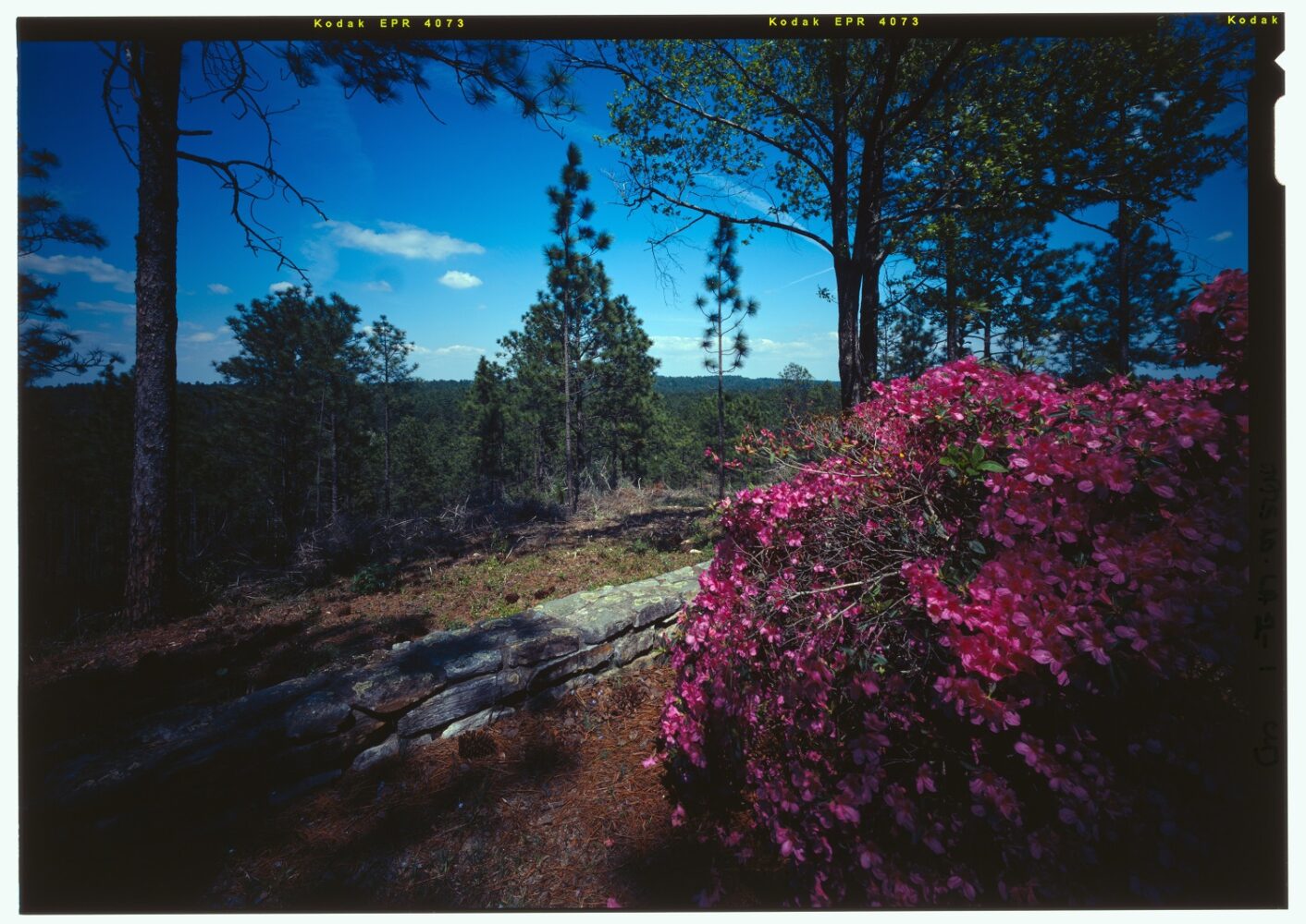
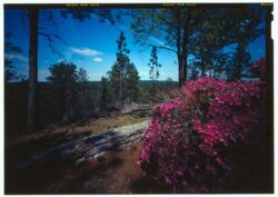
Photo by James Rosenthal, Historic American Landscapes Survey
A view of the Kisatchie National Forest near Natchitoches.
In a 2019 “Geographer’s Space” column, I analyzed the articles of 64 Parishes and found, rather unsurprisingly, that its geographical coverage leaned heavily toward more-populated and/or southern parishes and completely missed a number of rural parishes, particularly in central and northern areas. (64 Parishes now makes a concerted effort to live up to its name, as do I in this column.) All of which led me to wonder: where are our most remote areas—our least populated, least accessible spots, furthest from residences and roads? And what, if anything, do these spaces tell us about Louisiana culture?
To map unpeopled Louisiana, I gathered the most recent official data on populated areas and paved roads—that is, all regularly maintained municipal, parish, state, and federal streets, roads, and highways. Louisiana has over 102,000 miles of such arteries, and they spiderweb across the landscape with startling thoroughness. For population, I used 2010 Census data, because the 2020 tabulations were not available at press time (though results would not differ noticeably, given our meager growth, especially in rural areas).
Using a GIS computer mapping system, I removed from consideration all populated blocks and tracts, leaving only those rural or undeveloped areas where the Census Bureau recorded no people living in fixed, land-based dwellings. (We’ll save houseboats for another time.) Next came accessibility: I wanted to find those areas farthest from roads, as defined above. To do this, I calculated the Euclidean distance—that is, the straight-line distance radiating outwardly from every road—thus identifying those spaces most inaccessible by a vehicle. I removed water bodies from consideration, but retained swamps and marshes. The results are shown in the accompanying map, in which light gray represents humanity’s residential and arterial footprint, and green-to-blue indicates distance from both people and roads. The darker the shading, the more remote and inaccessible the area: these are Louisiana’s unpeopled places.
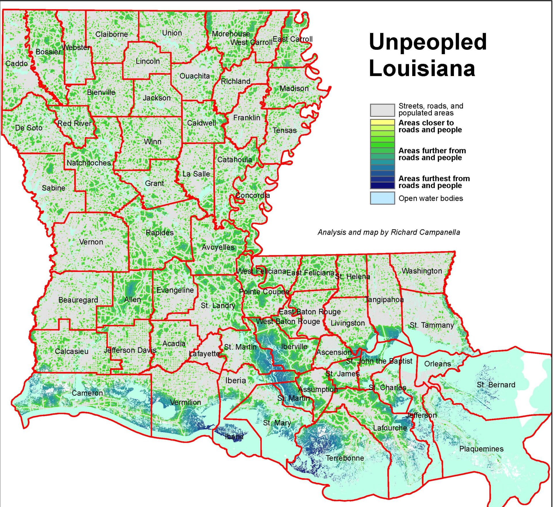
Certain patterns jump out. For one, the largest remote areas tend to be the tidally influenced marshes of our gulf-side parishes. Terrebonne Parish is salient, having the largest contiguous uninhabited area vis-à-vis a population largely concentrated along its inland edge. It’s interesting to note that some of our largest unpeopled places tend to have parish borders running through them (Iberville/St. Martin; Terrebonne/St. Mary; St. Bernard/Plaquemines; Plaquemines/Jefferson; Livingston/Tangipahoa/St. John the Baptist). The reason: many South Louisiana parishes were delineated with an eye to capture higher, riverine areas, home to most people and economic activity. Borders were then extended far back to mostly empty swamps and marshes, where they abutted the isolated rear flanks of other parishes.
Similarly, inland swamp basins, primarily the Atchafalaya and the Maurepas, form vast expanses with few roads and few people. Note the particularly large section of the Atchafalaya Swamp in Iberville, St. Martin, and Iberia Parishes between I-10 and Highway 90, and the many smaller spots in the swampy bottomlands of Avoyelles, St. Landry, and Pointe Coupee Parishes. Yet both the Atchafalaya and the Maurepas are proximate to Louisiana’s three largest urbanized areas; over half of the state’s population lives within fifty miles of the Maurepas Basin.
A glance at the central and northern parts of our map reveals similar propinquities of human absence and presence. Unpeopled places in those areas tend to be bottomlands, such as in the delta country of Morehouse and East Carroll Parishes near Arkansas and Mississippi. Yet as inaccessible as these patches are within their confines, they’re still fairly close to road networks and communities.
Because of the importance of rivers to our towns and cities, and of alluvial soils to our agriculture, peopled and unpeopled areas tend to be close neighbors in Louisiana. That paradoxical pairing of accessibility and remoteness helps explain the “Sportsman’s Paradise” reputation. You can get from city or suburb to duck blind or deer stand rather quickly here. Contrast this to many other states, particularly in the West, where peopled and unpeopled areas tend to be purer in their composition and more spatially removed from each other. Ninety percent of Utahns, for example, live on only 1 percent of Utah; by my calculations, 90 percent of Louisianans live on fully 20 percent of Louisiana—and much more if wetlands are excluded.
I had expected there would be large contiguous inaccessible areas in the piney woods of Kisatchie National Forest, home to the federally designated Kisatchie Hills Wilderness Area, and about as close as we have to rugged terrain. But in fact, this wooded region is crisscrossed with roads and communities, and while it shows up as apparent wildlands on forest-cover maps and satellite images, it doesn’t register prominently on our remoteness map.
There is, however, one part of the state where sizable remote spots could be found on well-drained uplands. It’s in Allen Parish, halfway between Alexandria and Lake Charles. About a third of its land is over a mile from paved roads and people, and around a third of its 25,000 residents live in or near the city of Oakdale.
What explains Louisiana’s fragmented landscape, where “gray” and “green” form such reticulated patterns? Much of it derives from the preponderance of wetlands and rivers, the former repellent to settlement, the latter attractive to it. Another reason is the rural, agrarian nature of our state, which equates to a more scattered population. We’re also a rather privatized state: roughly 90 percent of our land is privately controlled, compared to a 60 percent average among all states. Private land is more likely to be put to monetary use than public land, and that means roads, structures, and landscape fragmentation. Relatedly, the historic subdivision of former plantations into smaller farms, and the intermingling of French long-lots, irregular British metes-and-bounds parcels, and American township-and-range grids, all abetted a patchwork quilt of rural parcels never very far from towns and cities, with an intricate framework of roads.
The accessible inaccessibility of the Louisiana landscape means that even our wildest areas aren’t really “wilderness.” Humans have affected the hydrosphere, biosphere, and atmosphere of every square inch of our state. The most remote marshes of Terrebonne Parish have seen their salinity, sediments, sea level, vegetation composition, wildlife, and weather patterns altered by human activity, such that they’re probably better understood as cultural landscapes than as natural systems. Ergo, even these empty areas exude humanities content. Why did that salinity, sediment, and sea level change? What decisions were made to occasion this, and by whom? Who dug those trainasses in the marsh, trapped out the muskrats, introduced the nutria, and extracted the oil? Ditto the sedimentation in the Atchafalaya Swamp, the cut-over cypress forests in the stressed Maurepas Swamp, and the apparently dense forests of the hill country that are, in fact, timber farms.
Ours is a humanized landscape, every inch of it, even the unpeopled parts. You’ll find humanities stories everywhere, even if you struggle to get there.
Richard Campanella, a geographer with the Tulane School of Architecture, is the author of The West Bank of Greater New Orleans (LSU Press, 2020), Bienville’s Dilemma, Bourbon Street: A History, and other books. He may be reached at richcampanella.com, [email protected], or @nolacampanella on Twitter.