Magazine
Louisiana’s Loess Bluffs
A cultural region?
Published: November 30, 2020
Last Updated: February 28, 2021
United States Geological Survey
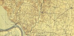
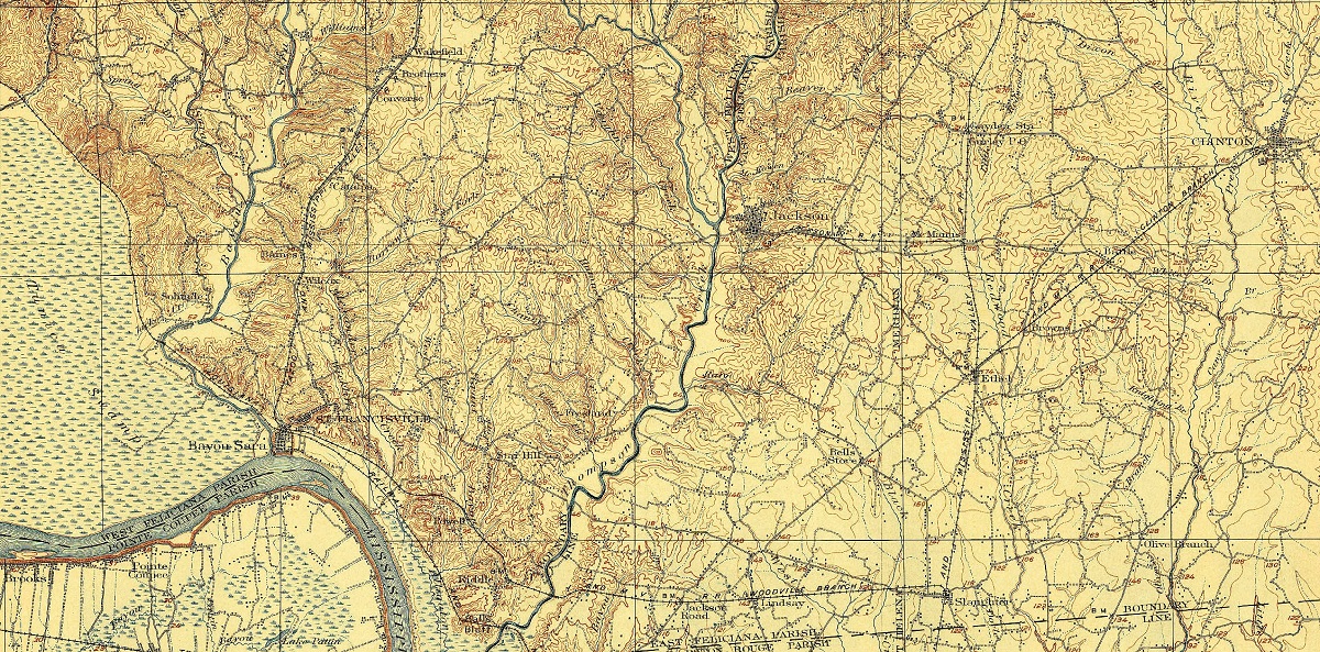
A 1906 map of the terrain around West Feliciana Parish shows loess bluffs to the right and smoother alluvial plain to the left.
Among Lyell’s topics that evening was the first scientific characterization of “the bluffs or cliffs bounding the great valley” of the Mississippi, rising “50 to 250 feet in perpendicular height, consist[ing] in great part of loam [and] occurring in a deposit resembling the loess of the Rhine.”
What Lyell was describing was that reddish silt known to anyone who’s driven the backroads of West Feliciana, Evangeline, or Catahoula Parishes and brought home some of the powdery soil on their bumper. Lyell called it “loess,” the term German scientists had coined (from löss, or los, equating to “loose” in English) to describe the similar silt deposited in the Rhine River Valley. Loess also occurs in Argentina, China, across Europe, in parts of Russia, and in the midwestern United States.
Silt is not a soil type per se, but rather a particle size, ranging from 0.004 to 0.06 millimeters in diameter, making it coarser and heavier than clay particles but finer and lighter than sand grains. It got deposited in vast quantities along the lower Mississippi Valley as a consequence of the end of the Ice Age. As glaciers receded from North America fifteen to twenty thousand years ago, they left behind debris of all sizes. Boulders and larger rocks generally stayed put, whereas smaller stones, gravel, sand, silt, and clay moved with the elements.
For millennia, spring runoff transported these smaller materials down a swollen Mississippi and its tributaries. Stones and gravel generally settled out, whereas finer alluvium moved onward. “The meltwater flowing down an extensive braided stream system spread the glacial sediment,” wrote Paul V. Heinrich of the Louisiana Geological Survey, “including large volumes of silt, over the Pleistocene floodplain of the Mississippi River.” In the autumn and winter, however, “the melting of the southern edges of the ice sheets largely ceased, [which caused] large areas of the previously flooded [valley] to become dry and [prone to] strong winds” blowing across the continent.
The winds lifted the sediments, and in doing so, sorted them. Sand, being the coarsest, got transported only short distances, while clay, being the lightest, travelled furthest and dispersed the widest. Silt was just light enough to get mobilized, but heavy enough to not make it too far. It settled in blanket-like layers across the wide swath of the lower Mississippi Valley.
The windborne silt fell in such quantities that it raised local elevations by dozens or hundreds of feet, forming loess bluffs. Streams and rivers easily scoured through the dusty deposits, leaving behind deep ravines and, in places, genuinely rugged terrain, as least by regional standards. Louisiana loess comprises mostly quartz and potassium feldspar, plus carbonate minerals including dolomite and calcite as well as mica. Weathering has leached out the carbonate and replaced it with local clay, which has allowed some deposits to concretize into what appear to be boulders or cliff faces. But despite their stony countenance, they remain soft and erodible, scratchable with a penny.
64 Parishes being a magazine of the humanities, we ask the question: do Louisiana’s loess bluffs, as distinct geophysical regions, also constitute cultural regions? The answer, I believe, is a conditional “yes.” Native Americans occupied the loess bluffs of the Maçon Ridge to avoid the floodplains of the Mississippi, and built Poverty Point thereupon.
Loess also helps explain why we have a legacy of plantation agriculture and slavery in West and East Feliciana Parishes, but mostly pine woodlands and a timber-and-cattle heritage just fifty miles to the east, in Washington and St. Tammany Parishes. Loess deposits had turned an otherwise less fertile swath of piney woods into highly productive land, as the loose texture enabled water to filtrate and integrate organic matter into the soil body, making it richer and loamier than the cohesive Pleistocene clays of adjacent regions. Settlers took advantage of these geophysical properties, and built upon it a cotton- and slavery-based economy, and thus a culture, distinct from less fertile adjacent areas. By extension, loess helps explain why the historic towns of Jackson and Clinton, with their antebellum homes and town-square layouts, look so different from, say, the linear railroad communities of Tickfaw and Independence, which mostly date to the late 1800s.
Conversely, along the western side of the Mississippi, loess bluffs along the Maçon Ridge iterate the division between the extremely fertile Holocene bottomlands of the upper Louisiana and Arkansas delta (read: cotton and soybean cultivation), and the Eocene uplands of the Kisatchie Wold (predominantly timber and oil-and-gas country). Because former plantation regions had substantial African American populations, whereas piney woods tended to have small farmsteads with isolated white populations, the geography of loess corresponded with the geography of race. To this day, the loess regions of Louisiana have higher percentages of African Americans compared to the uplands and piney woods.
At the same time, the undulating bluffs precluded the formation of the sort of economies and communities that took root in Louisiana’s coastal plains or prairielands. Loess thus becomes an explanatory factor of some of the cultural variation around our state. Where is this loess-based agriculture today? Mostly it is gone, a victim of soil erosion. Witness the hamlet of Rocky Springs near Vicksburg, Mississippi: once home to two thousand people along the Natchez Trace, it is now a ghost town, having lost its largesse of loess to poor farming practices. The same can be said of Louisiana loess regions. “Bluff and terrace soils have been highly productive of commercial crops—tobacco, cotton, and cane,” wrote the late geographer Fred B. Kniffen in Louisiana: Its Land and People. But “severe erosion . . . notably in West Feliciana Parish [has led to] extensive abandonment of agriculture in favor of raising beef cattle.”
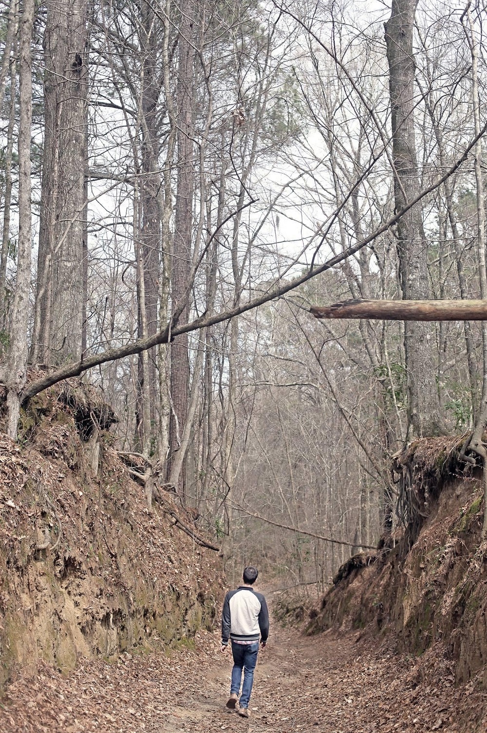
Loess terrain in West Feliciana Parish. Photo by Lucie Monk Carter
In places where loess bluffs are particularly rugged, populations tend to be too low to warrant designation as cultural regions. Sicily Island and parts of the Tunica Hills, for example, have plunging slopes too steep to farm or cut timber and sometimes even to graze, leaving them fairly wild and inaccessible. Instead of cultural regions, they are diverse ecological sanctuaries, their shady and cool microclimates being more akin to central Arkansas than central Louisiana. It’s no coincidence that large parts of both Sicily Island and the Tunica Hills are state wildlife management areas.
Louisiana’s loess bluffs make for ideal recreational areas. Next to Kisatchie National Forest, it’s the closest thing we have to hills, with even the occasional waterfall. Unfortunately, the best recreational access to loess bluffs for people in southeastern Louisiana is through southwestern Mississippi, namely Clark Creek Natural Area near Pond, and Clear Springs in Homochitto National Forest near Roxie. Wouldn’t it be wonderful if Tunica Hills could become a state park? This would open access to the beauty of the loess bluffs and the novelty of rugged terrain to our major population centers. Until then, if you head for the hills for a day of hiking, you’ll probably end up in Mississippi—and you’ll likely come home with reddish, powdery loess on your bumper, courtesy of the Ice Age.
Richard Campanella, a geographer with the Tulane School of Architecture, is the author of The West Bank of Greater New Orleans, Cityscapes of New Orleans, Bienville’s Dilemma, and other books. He may be reached at richcampanella.com, [email protected], or @nolacampanella on Twitter.